


TEXAS — Parts of Texas are expected to see severe thunderstorms Tuesday, though the tornado threat appears lower than areas farther north, according to the National Weather Service’s Storm Prediction Center.
The latest Day 1 Convective Outlook shows portions of north and north-central Texas within a broader risk area extending from the southern Plains into the Midwest. While the highest tornado threat is focused from Iowa into the southern Great Lakes, forecasters say isolated tornadoes cannot be ruled out in parts of Texas.
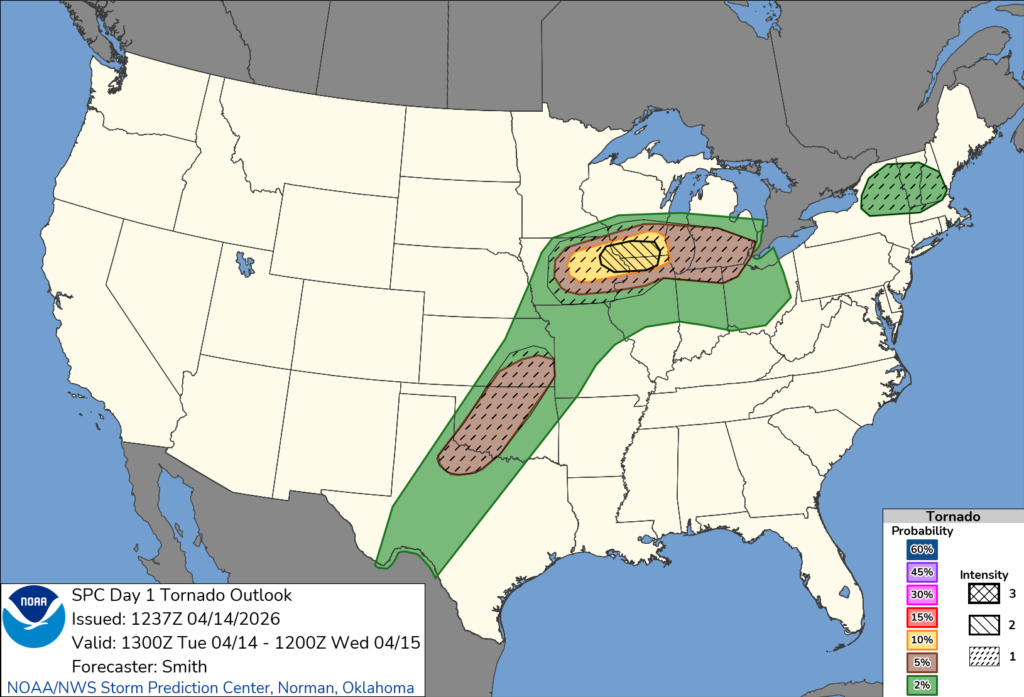
Meteorologists expect storms to develop during the afternoon and evening along a dryline stretching from Kansas into Texas. Strong daytime heating and an unstable atmosphere, with high levels of available energy, are expected to support storm development.
Some of these storms could become supercells — a type capable of producing severe weather, including large hail, damaging winds and possibly a brief tornado. However, forecasters indicate that large to giant hail may be the primary hazard across much of Texas, with the tornado risk more uncertain and likely more limited.
The Storm Prediction Center noted that while conditions may support tornado development, the strength of low-level wind shear — a key ingredient for tornadoes — remains unclear, which could limit the overall tornado threat.
Residents in north Texas are urged to remain weather-aware Tuesday afternoon and evening, as storms could intensify quickly and produce dangerous conditions.


