


INDIANA — Parts of Indiana are at risk for severe weather Tuesday, including the potential for tornadoes, as storms move into the region later in the day and continue into the evening, according to the National Weather Service’s Storm Prediction Center.
The latest Day 1 Convective Outlook places much of Indiana within a slight risk for severe thunderstorms, with a broader system expected to move in from the west. While the highest tornado threat is focused farther west from Iowa into Illinois and Wisconsin, forecasters say conditions across Indiana could still support tornado development.
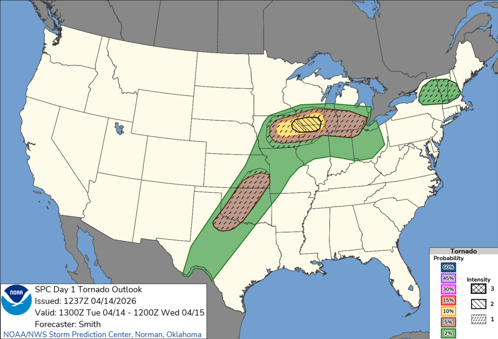
The Storm Prediction Center indicates a lower-end tornado probability across the state, but notes that a few tornadoes are possible, especially if individual storms remain discrete before merging into a larger system.
Meteorologists say storms are expected to develop to the west during the afternoon and track into Indiana by the evening hours. As they arrive, a warm and increasingly unstable air mass combined with strengthening winds aloft could allow storms to organize and intensify.
Damaging wind gusts are expected to be the primary threat across Indiana, along with the possibility of large hail. However, any supercell that develops ahead of the main line of storms could produce a tornado.
Residents are urged to stay weather-aware Tuesday afternoon and evening and be prepared to take shelter if warnings are issued, as storms could strengthen quickly.


