


WISCONSIN — Parts of Wisconsin are at risk for severe thunderstorms Sunday, with the National Weather Service’s Storm Prediction Center including portions of the state in a Marginal Risk (Level 1 of 5) for severe weather.
Forecasters say the greatest threat is expected to develop later Sunday evening into the overnight hours as warm, moist air spreads northward into the region. Thunderstorms are expected to develop along the northern edge of a warm front, where conditions will become favorable for stronger elevated storms.
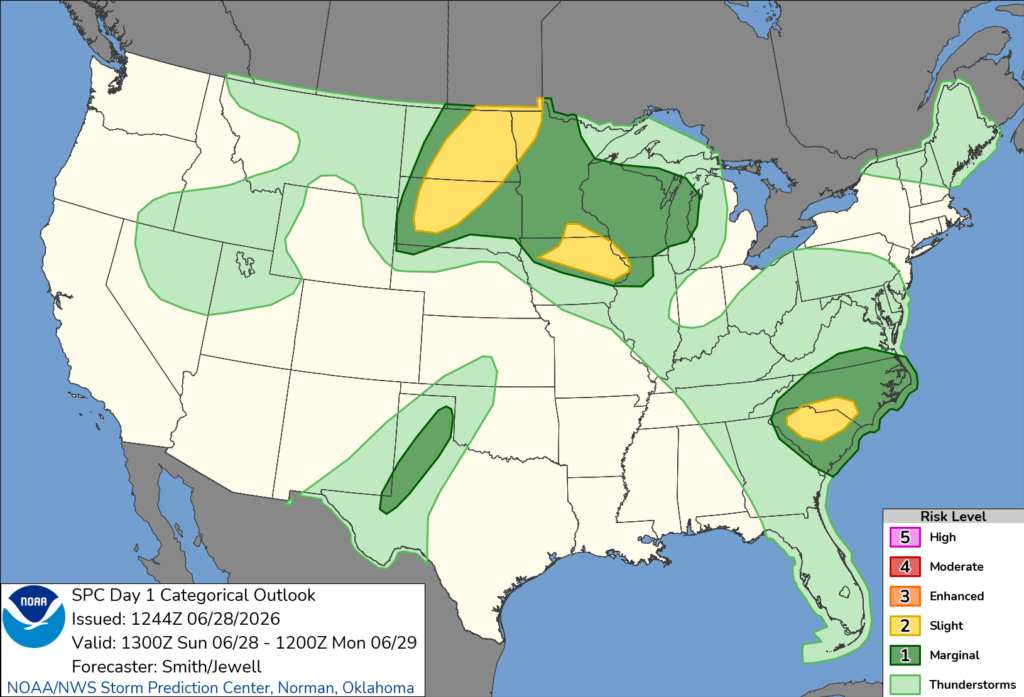
The primary threats include large hail and strong wind gusts. The Storm Prediction Center says isolated severe storms will be capable of producing large hail and locally damaging winds, particularly during the evening and overnight.
While the overall severe weather threat in Wisconsin is lower than areas farther west, forecasters say the atmosphere will contain enough instability to support stronger thunderstorms as moisture continues to increase above the surface.
Wisconsin is one of several states expected to experience severe weather Sunday. The greatest threat is forecast across portions of the Dakotas, where severe thunderstorms capable of producing very large hail and damaging winds are expected after dark. Wisconsin’s severe weather risk is expected to be more isolated but still capable of producing hazardous conditions.
Residents are encouraged to monitor the latest forecasts and have multiple ways to receive weather warnings, especially if they have outdoor plans or will be traveling Sunday evening or overnight.


