


SOUTH CAROLINA — Parts of South Carolina are at risk for severe thunderstorms Sunday, June 28, with the National Weather Service’s Storm Prediction Center placing portions of the state under a Slight Risk (Level 2 of 5) for severe weather.
Forecasters say thunderstorms are expected to develop during the afternoon and evening as a weather disturbance moves out of the southern Appalachian Mountains and into the Carolinas. Warm, humid air across the region is expected to provide favorable conditions for stronger storms.
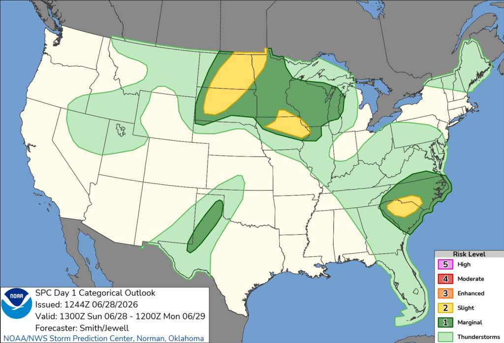
The primary threat is damaging straight-line wind gusts of 50 to 60 mph, which could down trees, damage power lines and lead to scattered power outages. The Storm Prediction Center said isolated to scattered wind damage is possible as thunderstorms organize into clusters.
Although widespread severe weather is not anticipated, some storms could become strong enough to produce localized wind damage, especially where the heaviest rain cores develop.
The severe weather threat includes parts of both North Carolina and South Carolina. Meteorologists say increasing daytime heating and a modest increase in winds higher in the atmosphere should help thunderstorms strengthen during the afternoon before continuing into the evening.
South Carolina is one of several regions across the country expected to see severe weather Sunday. While the most significant threat is forecast across parts of the northern Plains and Upper Midwest, where large to very large hail and severe winds are expected, damaging winds remain the primary concern across the Carolinas.
Residents are encouraged to stay weather-aware throughout the day, monitor the latest forecasts, and have multiple ways to receive severe thunderstorm warnings if they are issued.


