


NORTH CAROLINA — Parts of North Carolina are at risk for severe thunderstorms Sunday, June 28, with the National Weather Service’s Storm Prediction Center placing portions of the state under a Marginal and Slight Risk (Level 1 and 2 of 5) for severe weather.
Forecasters say the greatest threat will develop during the afternoon and evening as a disturbance moving out of the southern Appalachian Mountains pushes into the Piedmont. Warm, humid conditions are expected to create an environment favorable for stronger thunderstorms.
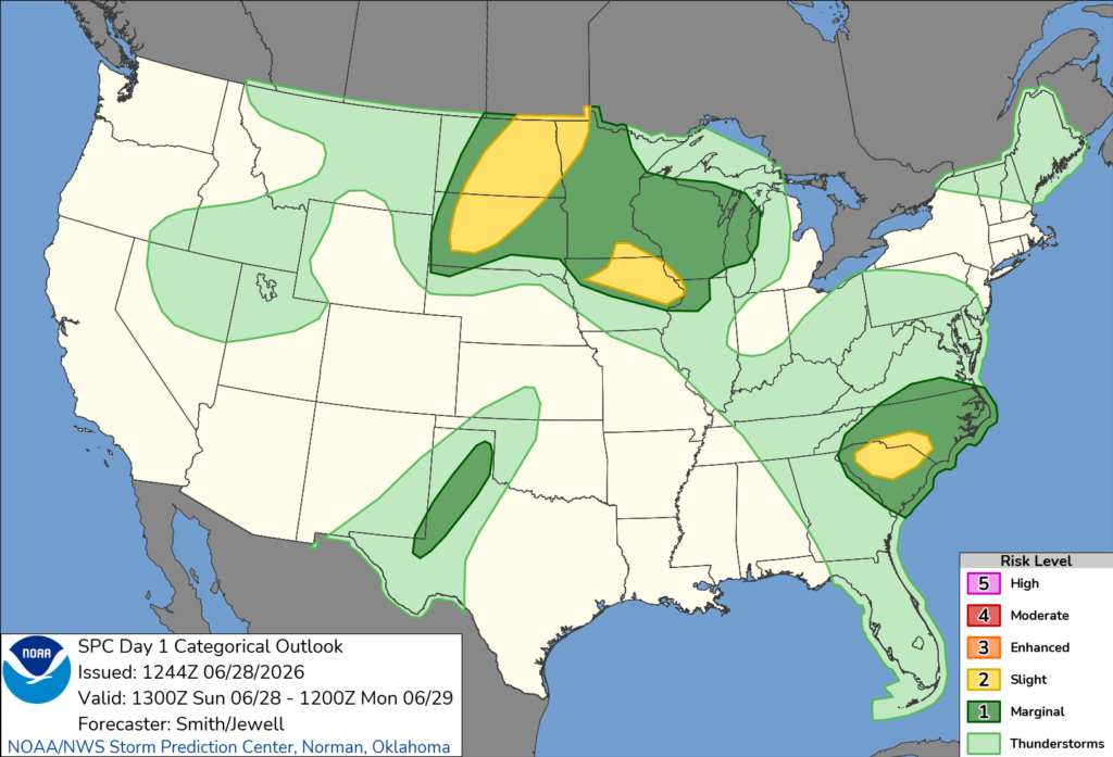
The primary concern is damaging straight-line wind gusts of 50 to 60 mph, which could bring down trees, damage power lines and cause scattered power outages. The Storm Prediction Center said isolated to scattered wind damage is possible as thunderstorms organize into clusters and intensify.
While widespread severe weather is not expected, officials say some storms could become strong enough to produce pockets of damaging winds, particularly with the most intense downpours.
The Storm Prediction Center noted that western North Carolina may begin the day with more cloud cover, but increasing daytime heating farther east is expected to help fuel thunderstorm development by early to mid-afternoon. A corridor of stronger winds aloft may also help storms become better organized as they move across parts of the state.
North Carolina is one of several areas across the country expected to experience severe weather Sunday. The most significant threat is forecast across portions of the Dakotas, Minnesota and Iowa, where large to very large hail and severe winds are expected. In the Carolinas, however, damaging winds remain the main hazard.
Residents are encouraged to monitor the latest forecasts throughout the day and have multiple ways to receive weather warnings in case severe thunderstorms develop.


