


MARYLAND — Maryland is facing a dangerous combination of severe thunderstorms and heavy rainfall Monday, with much of the state under a Severe Thunderstorm Watch until 9 p.m. EDT as multiple rounds of storms move through the region.
According to the National Weather Service and Storm Prediction Center, the watch includes Allegany, Anne Arundel, Baltimore, Calvert, Caroline, Carroll, Cecil, Charles, Dorchester, Frederick, Harford, Howard, Kent, Montgomery, Prince George’s, Queen Anne’s, Somerset, St. Mary’s, Talbot, Washington, Wicomico and Worcester counties, as well as Baltimore City.
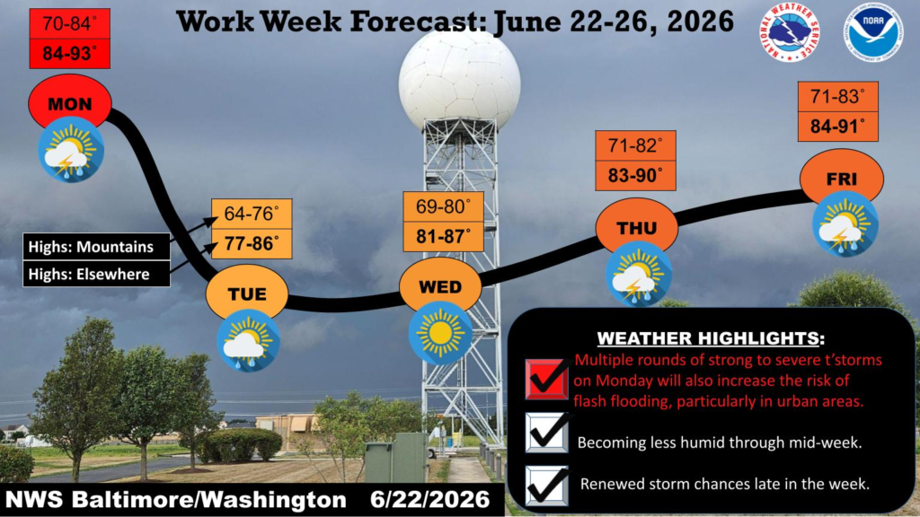
Forecasters say scattered strong to severe thunderstorms will develop over the mountains before moving east across Maryland through the evening. The primary threat is damaging wind gusts of 50 to 65 mph, although torrential rainfall could also produce localized flash flooding, particularly in urban and poor-drainage areas.
The severe weather is expected to ease after Monday night before conditions improve during the middle of the week. Tuesday will bring slightly cooler temperatures and fewer storms, while Wednesday is expected to be the driest day of the week with lower humidity and mostly sunny skies.
Storm chances are forecast to increase again Thursday and Friday as warmer, more humid air returns to the region, bringing the potential for additional afternoon and evening thunderstorms.
The National Weather Service urges Maryland residents to remain weather aware throughout Monday evening, monitor forecasts, and be prepared to seek shelter if Severe Thunderstorm Warnings are issued for their area.


