


NORTH CAROLINA — UPDATE: The watches have expired.
—
Scattered thunderstorms are expected to develop across central North Carolina Monday afternoon and evening, with some storms capable of becoming severe, according to the National Weather Service.
Much of central North Carolina is under a Level 2 (Slight Risk) for severe weather, while eastern portions of the region are under a Level 1 (Marginal Risk).
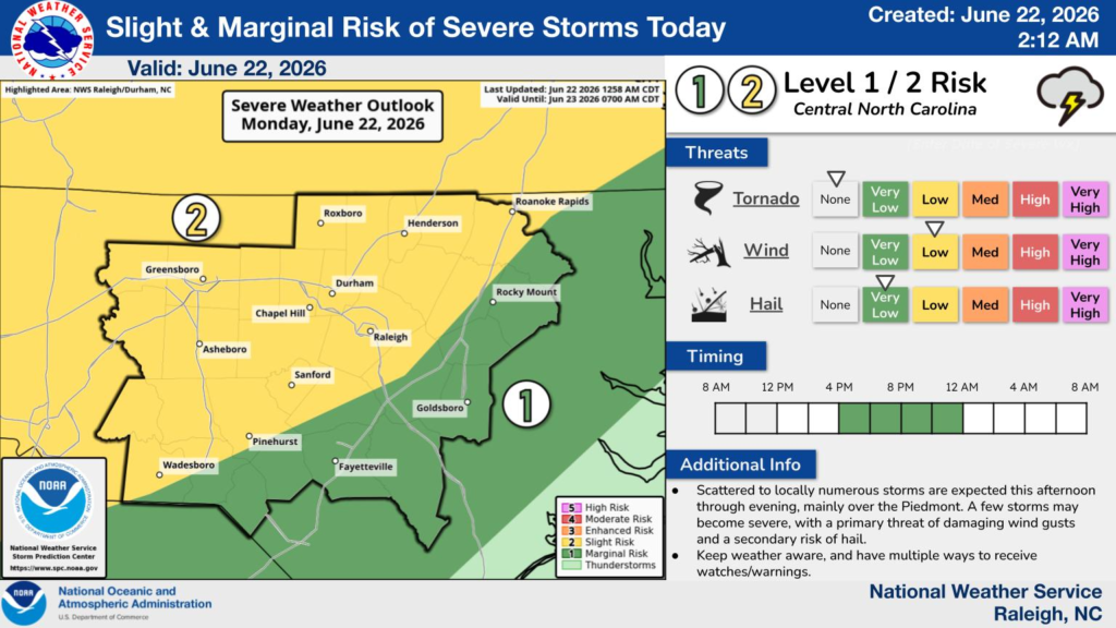
Forecasters say storms are expected to become more numerous during the afternoon and continue into the evening, primarily across the Piedmont. The greatest threat will be damaging wind gusts, with hail serving as a secondary hazard. While the tornado threat is considered low, residents should remain alert as storms move through.
A Severe Thunderstorm Watch has also been issued for portions of central North Carolina until 11 p.m. EDT, including Alamance, Caswell, Chatham, Davidson, Durham, Forsyth, Franklin, Granville, Guilford, Halifax, Nash, Northampton, Orange, Person, Randolph, Rockingham, Stokes, Vance, Wake and Warren counties.
The National Weather Service encourages residents to closely monitor weather conditions throughout the afternoon and evening and ensure they have multiple ways to receive watches and warnings as storms approach.


