


ALABAMA — A developing severe weather system expected to move across Alabama on Tuesday is raising concerns that some schools could close or dismiss early due to potentially hazardous conditions.
The National Weather Service’s Storm Prediction Center has placed much of northern and central Alabama under a “slight risk” for severe thunderstorms, with storms expected to strengthen as they move east through the state Tuesday afternoon and evening.
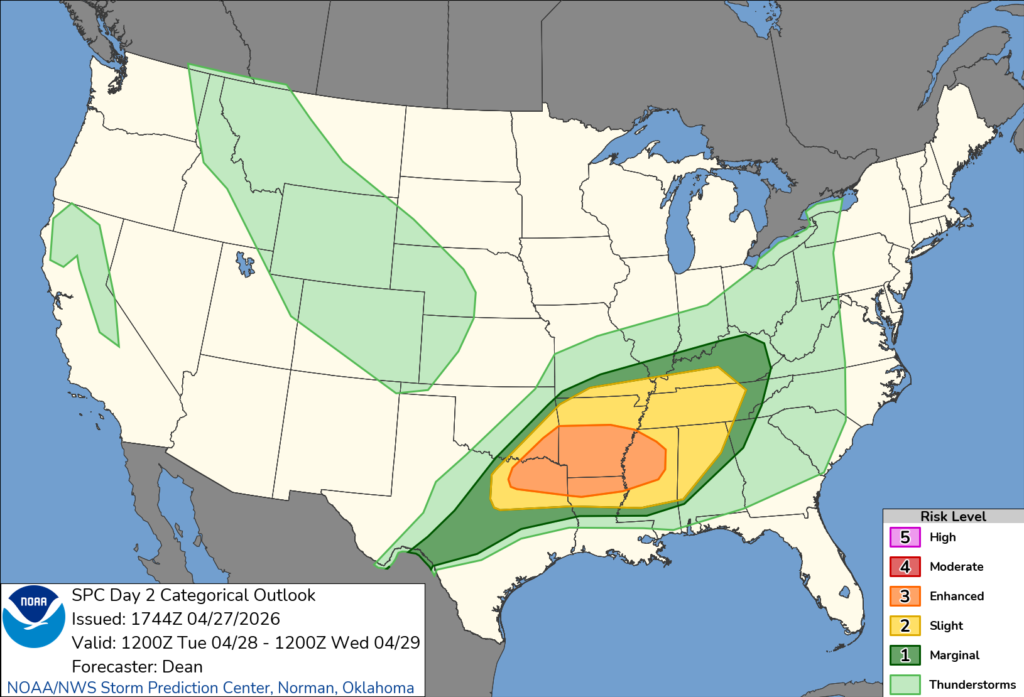
Forecasters warn the system could bring damaging winds, large hail and the possibility of tornadoes. In addition, heavy rainfall may lead to localized flooding, creating dangerous travel conditions across the region.
The timing of the storms could coincide with school dismissal hours, prompting districts to closely monitor the forecast. Strong winds and saturated ground may lead to downed trees and power outages, while flooded roadways could make bus routes unsafe or impassable.
School systems may choose to cancel classes, move to remote learning or dismiss students early to avoid transporting them during the most dangerous conditions.
Emergency management officials are urging families to stay alert for possible schedule changes and to prepare for potential power outages or rapidly changing weather conditions.
Forecasters say storms could organize into clusters or a line as they track eastward, increasing the risk for widespread wind damage into the evening hours.
Residents are encouraged to monitor local forecasts, have multiple ways to receive weather alerts and be prepared for rapidly changing conditions.


