


VIRGINIA — UPDATE: The watches have expired.
—
The National Weather Service’s Storm Prediction Center has issued a Severe Thunderstorm Watch for portions of southeast Virginia through 9 p.m. EDT Saturday as strong to severe thunderstorms develop across the region.
The watch includes the Virginia independent cities of Chesapeake, Norfolk, Portsmouth and Virginia Beach.
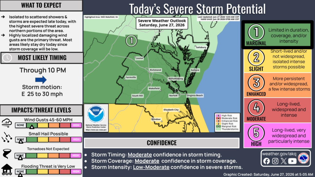
According to the National Weather Service in Wakefield, much of southeast Virginia remains under a Level 1 of 5 (Marginal Risk) for severe weather Saturday, while areas farther south into northeastern North Carolina are under a Level 2 (Slight Risk).
Forecasters say isolated to scattered showers and thunderstorms are expected through the evening, with the greatest potential for severe weather across the northern portion of the region. However, storm coverage is expected to remain relatively limited, and many locations may stay dry.
The primary threat is localized damaging wind gusts between 45 and 60 mph. Small hail is also possible, while tornadoes are not expected and the flooding threat remains very low.
Storms are expected to continue through about 10 p.m., moving east at 25 to 30 mph.
The Severe Thunderstorm Watch also includes portions of nearby coastal waters, including the James River, Currituck Sound, the coastal Atlantic waters near the Virginia-North Carolina border, and surrounding marine areas.
Residents are encouraged to remain weather aware throughout the afternoon and evening, monitor forecasts, and have multiple ways to receive warnings in case severe weather develops.


