


TENNESSEE — UPDATE: The watches have expired.
—
The National Weather Service’s Storm Prediction Center has issued a Severe Thunderstorm Watch for portions of Middle and West Tennessee through 8 p.m. CDT Saturday as strong to severe thunderstorms are expected to develop across the region.
The watch includes the counties of Benton, Cannon, Cheatham, Davidson, Dickson, Henry, Hickman, Houston, Humphreys, Lake, Macon, Maury, Montgomery, Obion, Robertson, Rutherford, Smith, Stewart, Sumner, Trousdale, Weakley, Williamson and Wilson.
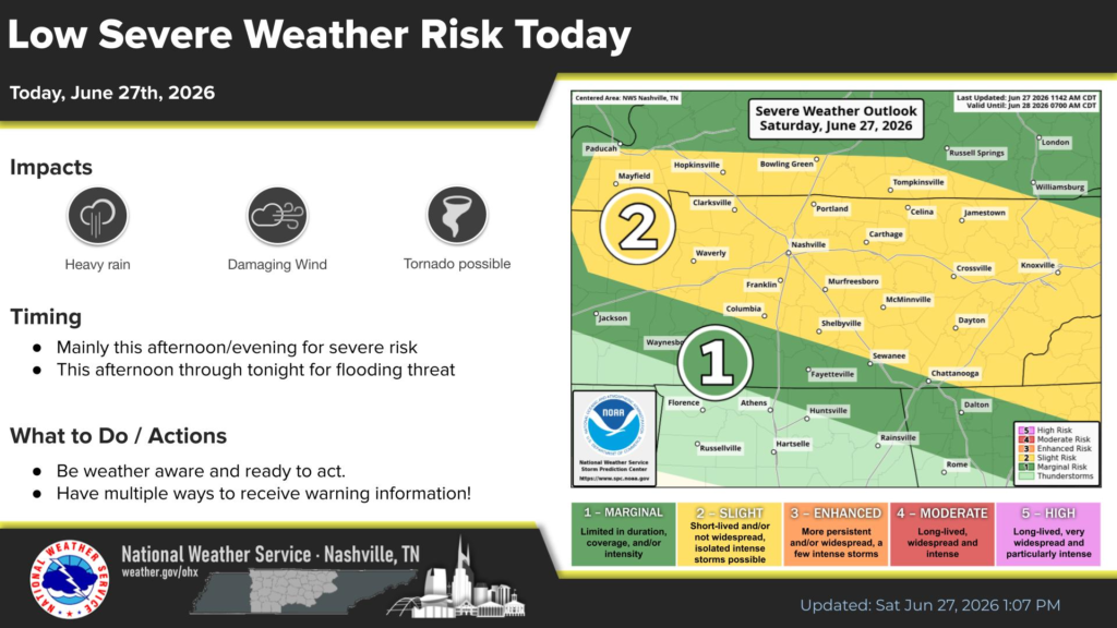
According to the National Weather Service in Nashville, much of Middle Tennessee remains under a Level 2 of 5 (Slight Risk) for severe weather Saturday, while areas farther south are under a Level 1 (Marginal Risk).
Forecasters say the primary threats include damaging wind gusts, heavy rainfall and the potential for an isolated tornado. In addition to the severe weather threat, localized flooding is possible as rounds of showers and thunderstorms move through the area.
The greatest risk for severe storms is expected this afternoon and evening, while the flooding threat could continue through tonight.
Residents are urged to remain weather aware, have multiple ways to receive warnings, and be prepared to take shelter if severe weather approaches or warnings are issued.


