


NORTH CAROLINA — UPDATE: The watches have expired.
—
The National Weather Service’s Storm Prediction Center has issued a Severe Thunderstorm Watch for portions of North Carolina, including 40 counties, through 9 p.m. EDT Saturday as strong to severe thunderstorms move across the region.
The watch, designated Severe Thunderstorm Watch 404, includes much of central, eastern and northeastern North Carolina, including Wake, Durham, Cumberland, Johnston, Wayne, Pitt, Nash, Wilson, Orange, Chatham, Harnett, Moore and several surrounding counties.
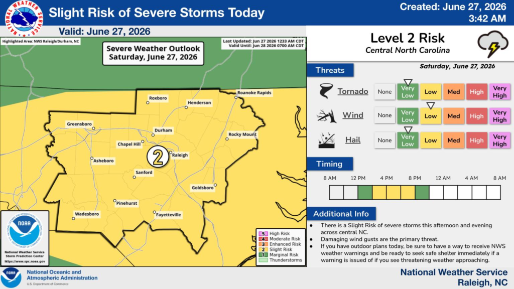
According to the National Weather Service in Raleigh, much of central North Carolina remains under a Level 2 of 5 (Slight Risk) for severe weather Saturday afternoon and evening.
Forecasters say damaging wind gusts are the primary threat, although isolated hail is also possible. The tornado threat remains very low.
The greatest risk for severe storms is expected during the afternoon and early evening hours, with conditions improving later tonight as the storms move out of the area.
Residents are encouraged to closely monitor weather conditions throughout the day, especially if they have outdoor plans. Officials recommend having multiple ways to receive weather warnings and being prepared to move indoors immediately if a Severe Thunderstorm Warning is issued or threatening weather approaches.
The Severe Thunderstorm Watch includes the following North Carolina counties:
Beaufort, Bertie, Camden, Chatham, Chowan, Cumberland, Currituck, Dare, Duplin, Durham, Edgecombe, Franklin, Gates, Granville, Greene, Halifax, Harnett, Hertford, Hoke, Hyde, Johnston, Lee, Lenoir, Martin, Moore, Nash, Northampton, Orange, Pasquotank, Perquimans, Person, Pitt, Sampson, Tyrrell, Vance, Wake, Warren, Washington, Wayne and Wilson.


