


MINNESOTA — Minnesota is at risk for severe thunderstorms on Wednesday as forecasters warn that multiple rounds of storms could bring damaging winds, large hail and a few tornadoes across parts of the state.
The National Weather Service’s Storm Prediction Center has placed portions of Minnesota in an Enhanced Risk for severe weather, with the greatest concern centered on southern Minnesota.
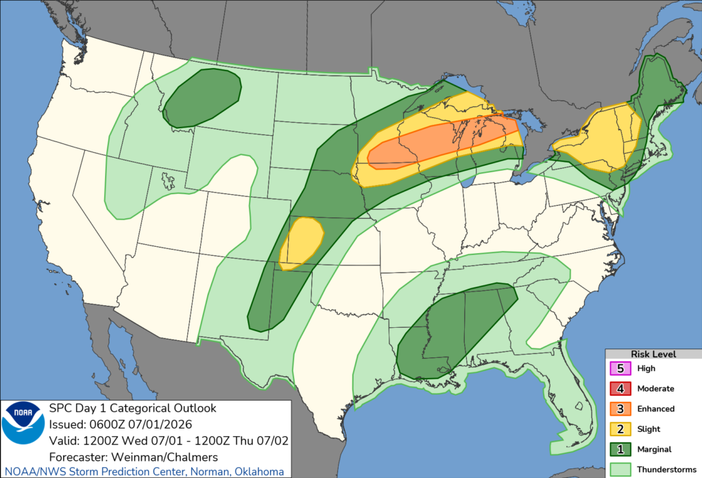
Forecasters say strong to severe thunderstorms are expected to be ongoing or develop during the morning across southern Minnesota before spreading east-northeast. These storms could produce damaging wind gusts and large hail.
As temperatures warm through the day, atmospheric conditions are expected to become increasingly favorable for severe weather. The combination of warm, humid air and strong wind shear could support both supercell thunderstorms and organized storm clusters capable of producing widespread severe weather.
A second round of thunderstorms is expected to develop near southern Minnesota during the afternoon and evening before moving east-northeast. This round has the potential to produce the most significant impacts, including damaging wind gusts that could reach 80 mph, large to very large hail and a few tornadoes.
The Storm Prediction Center said scattered severe thunderstorms are expected across the Upper Midwest and Great Lakes through Wednesday and Wednesday night, with damaging winds posing the greatest threat.
Residents across Minnesota are encouraged to closely monitor weather forecasts throughout the day and have multiple ways to receive warnings as conditions can change rapidly.


