


IOWA — Iowa is expected to see multiple rounds of severe thunderstorms Wednesday as forecasters warn of damaging winds, large hail and a possible tornado threat across parts of the state.
The National Weather Service’s Storm Prediction Center has placed much of Iowa under a Marginal Risk for severe weather, while portions of western and northern Iowa are included in a Slight Risk. The greatest threat is expected across northern Iowa, where storms developing in southern Minnesota are forecast to move east-northeast into the region.
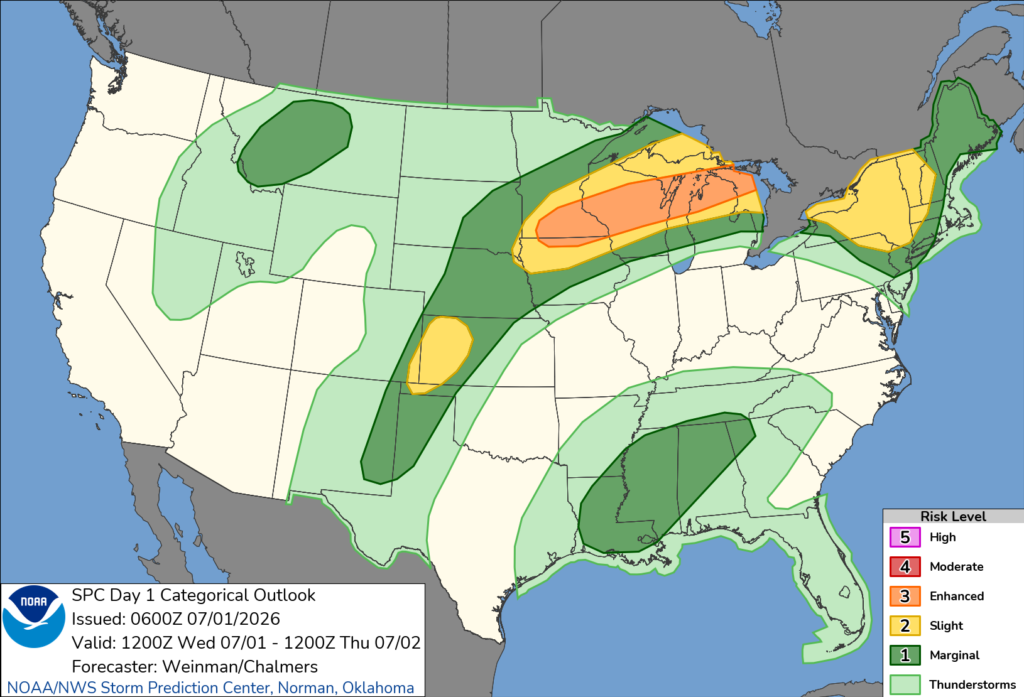
Forecasters say an initial round of strong to severe thunderstorms could move through during the morning, bringing damaging wind gusts and large hail. Additional thunderstorms are expected to develop later in the afternoon and evening as atmospheric conditions become more favorable for severe weather.
Storms that develop later in the day could organize into stronger clusters capable of producing damaging wind gusts, large to very large hail and an isolated tornado, especially across northern Iowa.
The Storm Prediction Center said severe thunderstorms are expected across the Upper Midwest through Wednesday and Wednesday night, with damaging winds serving as the primary hazard.
Iowans are encouraged to monitor the latest forecasts throughout the day and have multiple ways to receive weather warnings as conditions can change quickly.


