


VIRGINIA — A widespread freeze watch is in effect across much of Virginia late Monday night into Tuesday morning, with forecasters warning of sub-freezing temperatures that could impact travel, damage vegetation and potentially lead to school delays or closures early April 21.
The National Weather Service said temperatures are expected to drop into the upper 20s to near 32 degrees across a large portion of the state, including northern Virginia counties such as Fairfax, Prince William, Stafford and Arlington, as well as central Virginia areas including Albemarle, Nelson, Goochland, Fluvanna and Prince Edward counties.
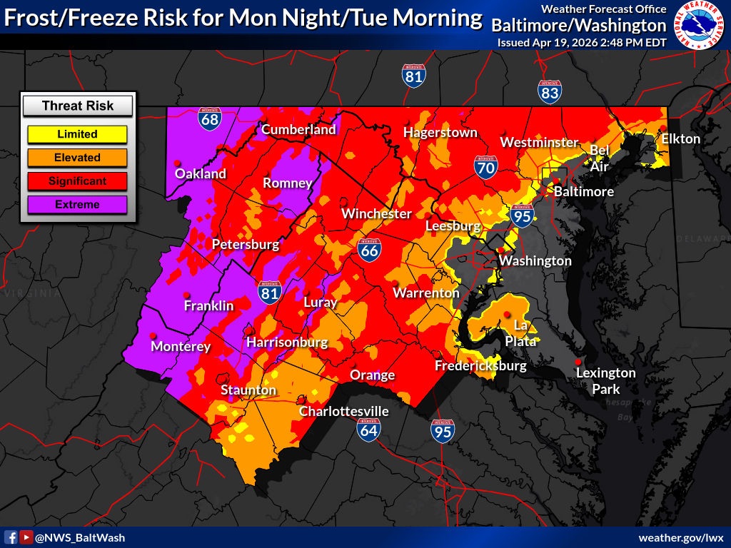
Additional portions of western and southwest Virginia — including Roanoke, Montgomery, Pulaski, Bedford, Amherst and Pittsylvania counties — are also included in the freeze watch, with similar cold conditions expected.
Forecasters warn that any moisture left on roadways could freeze overnight, particularly on bridges, overpasses and untreated secondary roads. While the primary threat is freezing temperatures, some areas — especially in higher elevations — could also see isolated light snow showers or a rain-to-snow mix late Monday night into early Tuesday.
Although any snow accumulation is expected to be minimal, even light precipitation combined with freezing temperatures could create slick spots for the Tuesday morning commute.
The combination of icy roadways and cold temperatures may prompt some school districts, particularly in rural or mountainous areas, to consider delays or closures Tuesday morning.
In addition to travel concerns, officials warn that frost and freezing conditions could damage crops, sensitive vegetation and exposed outdoor plumbing.
Residents are urged to take precautions, including protecting plants, covering outdoor pipes and allowing extra travel time during the morning commute.


