


OHIO — Multiple areas across Ohio remain under Flood Watches Saturday as forecasters warn additional rounds of heavy rain could trigger flash flooding in communities already dealing with saturated ground conditions.
According to the National Weather Service, Flood Watches are in effect across portions of central, eastern and southern Ohio through Saturday afternoon and evening.
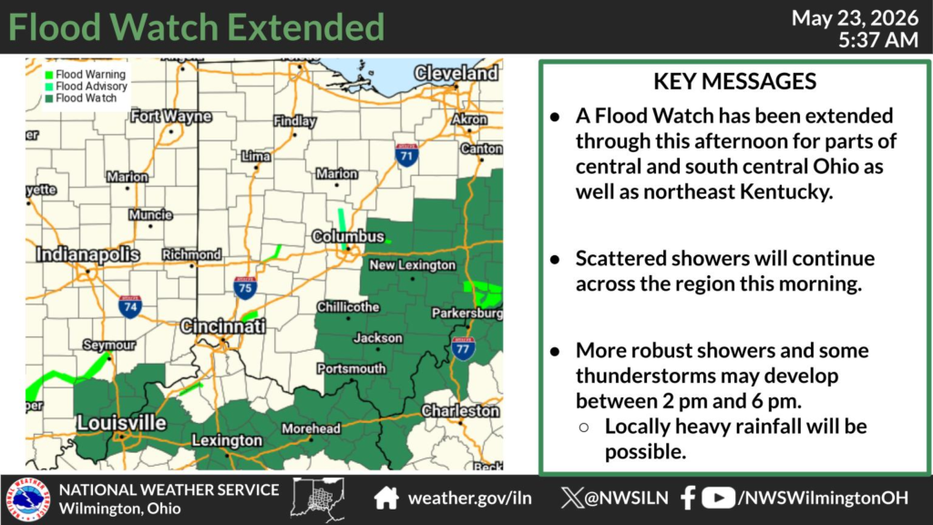
The National Weather Service office in Wilmington said Fairfield, Hocking, Licking, Pike, Ross and Scioto counties are under a Flood Watch through Saturday afternoon. Forecasters warned that additional showers and thunderstorms could produce locally heavy rainfall, increasing the risk of rapid runoff and flash flooding in low-lying and flood-prone areas.
In eastern Ohio, the National Weather Service in Pittsburgh continued a Flood Watch until 2 p.m. Saturday for Belmont, Carroll, Coshocton, Guernsey, Harrison, Jefferson, Monroe, Muskingum, Noble and Tuscarawas counties. Meteorologists said another 1 to 1.5 inches of rain could fall in isolated storms late Saturday morning into the afternoon.
Additional Flood Watches are also in effect through Saturday evening for Athens, Gallia, Jackson, Lawrence, Meigs, Morgan, Perry, Vinton and Washington counties in southeastern Ohio, according to the National Weather Service in Charleston, West Virginia. Officials said creeks, rivers and streams are already elevated from recent rainfall and could quickly overflow if more heavy rain develops.
Forecasters warned that flooding may occur along rivers and streams, in urban areas with poor drainage and in other flood-prone locations. Residents are urged to monitor weather alerts closely and be prepared to take action if Flash Flood Warnings are issued.


