


KENTUCKY — Several areas of Kentucky remain under Flood Watches Saturday as forecasters warn additional heavy rainfall could lead to flash flooding in already saturated regions.
According to the National Weather Service, Flood Watches are in effect across portions of northeast and east-central Kentucky through Saturday afternoon and evening.
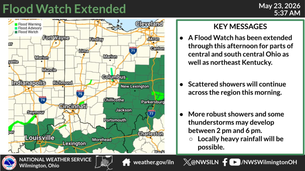
In northeast Kentucky, Lewis County remains under a Flood Watch through Saturday afternoon. The National Weather Service in Wilmington, Ohio, said additional showers and thunderstorms could bring locally heavy rainfall to areas with already soaked ground, increasing the threat of rapid runoff and flash flooding.
The National Weather Service office in Jackson, Kentucky, has also extended a Flood Watch through Saturday evening for Bath, Elliott, Fleming, Montgomery and Rowan counties. Forecasters said another one to two inches of rain could fall in some locations as additional rounds of thunderstorms move through the area.
Meanwhile, the National Weather Service in Charleston, West Virginia, issued a Flood Watch through Saturday evening for Boyd, Carter, Greenup and Lawrence counties in northeastern Kentucky. Officials warned that rivers, creeks and streams are already running high after several days of rain and could quickly flood if more heavy rainfall develops.
The National Weather Service in Louisville also continued a Flood Watch through noon Saturday for parts of central Kentucky, including Bourbon, Clark, Fayette, Franklin, Harrison, Henry, Jefferson, Jessamine, Nicholas, Oldham, Scott, Shelby, Trimble and Woodford counties.
Forecasters warned that flooding may occur in low-lying areas, along creeks and streams, and in locations with poor drainage. Residents in flood-prone areas are encouraged to monitor weather updates closely and be prepared to take action if Flash Flood Warnings are issued.


