


OHIO — A Flood Watch has been issued for much of southern Ohio from Friday afternoon through Saturday morning as multiple rounds of showers and thunderstorms are expected to bring heavy rainfall and increase the risk of flash flooding.
The National Weather Service said excessive rainfall could cause flash flooding across Adams, Athens, Brown, Butler, Clermont, Clinton, Fayette, Gallia, Hamilton, Highland, Jackson, Lawrence, Meigs, Pike, Ross, Scioto, Vinton and Warren counties.
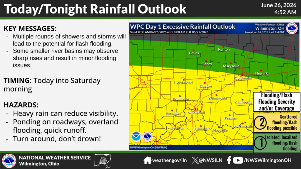
Forecasters warn that repeated rounds of rain and thunderstorms may produce excessive runoff, leading to flooding of rivers, creeks, streams and other low-lying or flood-prone areas. Ponding of water on roadways and rapid runoff are also expected, which could make travel hazardous.
The National Weather Service’s Weather Prediction Center places much of southern Ohio under a Level 2 of 4 risk for excessive rainfall, indicating scattered instances of flash flooding are possible. Areas farther north are under a Level 1 of 4 risk, where isolated, localized flooding could occur.
According to the National Weather Service in Wilmington, multiple rounds of showers and thunderstorms are expected from Friday through Saturday morning. Smaller river basins could experience rapid rises, potentially resulting in minor flooding. Heavy rain may significantly reduce visibility, and motorists are urged to avoid driving through flooded roads.
Residents in flood-prone locations should closely monitor the latest forecasts and be prepared to act if Flash Flood Warnings are issued. Officials remind drivers to “Turn Around, Don’t Drown,” as even shallow floodwaters can be dangerous.


