


ILLINOIS — Parts of Illinois are facing a significant threat of severe weather, including the potential for tornadoes, as storms are expected to develop Tuesday afternoon and continue into the evening, according to the National Weather Service’s Storm Prediction Center.
The latest Day 1 Convective Outlook places northern and central Illinois within an enhanced risk area for severe thunderstorms, with conditions favorable for multiple rounds of dangerous weather. Forecasters say the primary threats include large to giant hail, damaging wind gusts and several tornadoes, some of which could be strong.
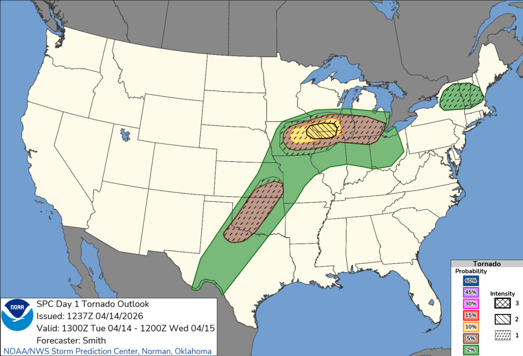
A corridor of higher tornado potential stretches into northern Illinois, including areas near Rockford, Elgin and the Chicago metro region. The Storm Prediction Center indicates that a 10% tornado probability exists across portions of the state, signaling a notable risk for tornado development.
Meteorologists say storms are expected to form along a boundary extending from eastern Iowa into southern Wisconsin and northern Illinois by mid to late afternoon. As instability increases and wind shear strengthens, storms are likely to quickly intensify into supercells — the type of storm most capable of producing tornadoes.
Forecasters also warn that atmospheric conditions, including strong instability and favorable wind profiles, could support intense tornadoes with the strongest storms.
As the evening progresses, storms may merge into a larger system, continuing the threat of severe weather across Illinois and into the southern Great Lakes.
Residents are urged to stay weather-aware throughout the day and be prepared to take shelter if warnings are issued.


