


IOWA — Parts of Iowa could see severe thunderstorms Monday as a weather system moves across the northern Plains into the Upper Midwest, bringing the potential for large hail, damaging winds, and a few tornadoes.
According to the National Weather Service’s Storm Prediction Center, portions of Iowa are included in a Slight Risk for severe thunderstorms through early Tuesday morning.
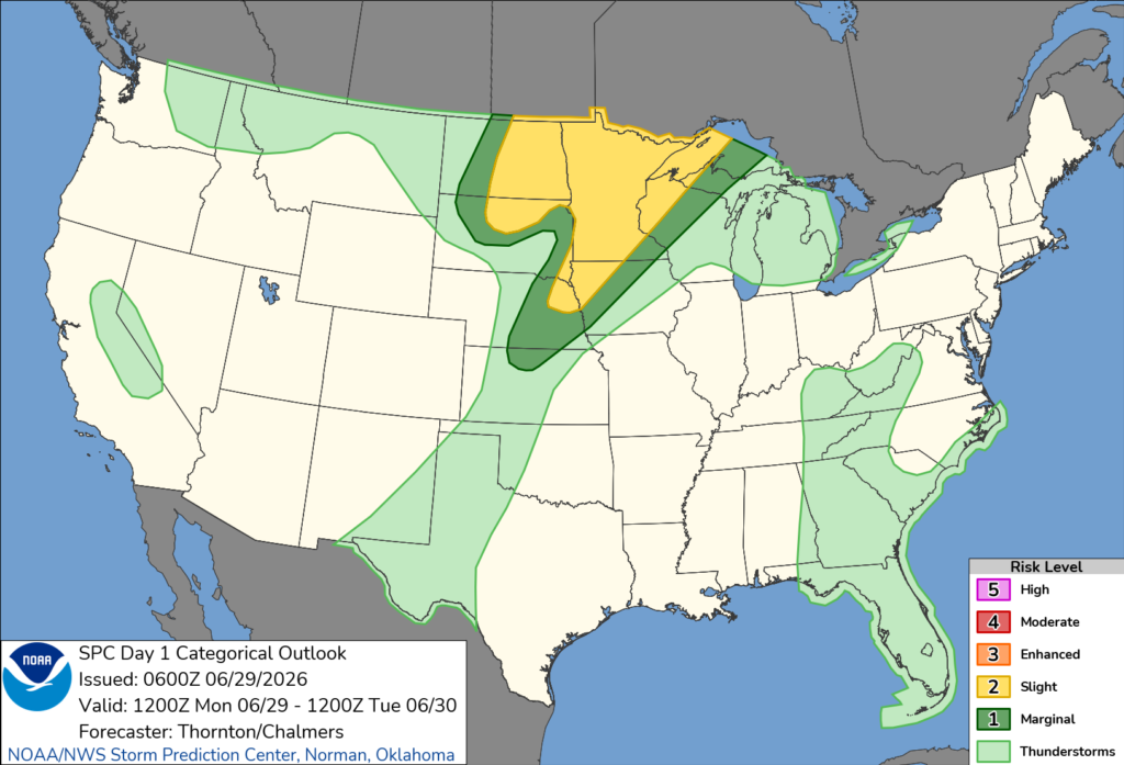
Forecasters say thunderstorms may develop later Monday as a cold front advances into the region. While confidence in the exact timing and evolution of storms remains uncertain, atmospheric conditions are expected to become increasingly favorable for severe weather during the afternoon and evening.
Meteorologists say strong instability and favorable wind shear will support the development of organized thunderstorms, including supercells. Large hail and damaging straight-line winds are expected to be the primary threats, though a couple of tornadoes cannot be ruled out if storms remain discrete before clustering together.
As storms evolve through the evening, some may organize into larger clusters capable of producing widespread damaging wind gusts. Areas farther west may experience the strongest storms as instability increases ahead of the advancing cold front.
Forecasters note there is still uncertainty regarding how storms will develop throughout the day, but residents are encouraged to monitor the latest forecasts and have multiple ways to receive weather warnings if severe weather develops.


