


LOUISIANA — Parts of Louisiana face a risk of tornadoes Wednesday as a severe weather system moves across the region, according to the National Weather Service’s Storm Prediction Center.
Northern and central Louisiana are included in an enhanced risk area for severe thunderstorms, indicating a higher likelihood of dangerous weather. Forecasters say storms are expected to develop Wednesday afternoon and continue into the evening, with conditions supportive of tornado-producing thunderstorms.
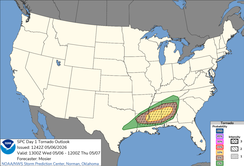
The Storm Prediction Center notes that supercells — storms capable of producing all types of severe weather — are expected to form across portions of the lower Mississippi Valley, including Louisiana. While large hail and damaging winds are possible, the tornado threat remains a primary concern, especially if storms can remain isolated and organized.
Meteorologists say increasing moisture and strong wind patterns in the atmosphere will create favorable conditions for rotating storms. The tornado risk is expected to increase later in the day as low-level winds strengthen, enhancing the potential for storms to produce brief or possibly stronger tornadoes.
Areas across northern Louisiana, including communities near the Arkansas border and into central parts of the state, are most at risk. However, storms could impact a broader portion of Louisiana as they move eastward.
Residents are urged to remain weather-aware, have multiple ways to receive warnings, and be prepared to seek shelter quickly if a tornado warning is issued.


