


TEXAS — A threat of severe weather across parts of North and Northeast Texas on Tuesday could lead to potential school closures or schedule changes if hazardous conditions develop.
According to the National Weather Service’s Storm Prediction Center, areas of North Texas are included in both a “slight risk” and “marginal risk” for severe thunderstorms Tuesday afternoon and evening. The slight risk area extends into Northeast Texas, while surrounding parts of North Texas remain under a marginal risk.
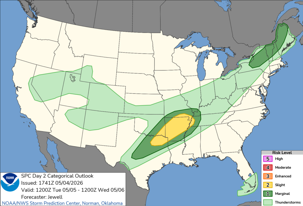
Forecasters say scattered strong to severe storms are possible, with hazards including large hail, damaging wind gusts and the potential for a few tornadoes. The storms are expected to develop later in the day as a surface trough forms from northern Texas into Oklahoma and Arkansas.
While no widespread closures had been announced as of Monday, school officials typically monitor conditions such as power outages, downed trees and flooded roads when determining whether it is safe to hold classes or operate buses.
The Storm Prediction Center noted that cities including Dallas, Plano, Garland and Irving fall within the slight risk area, while Fort Worth, Arlington and Waco are within the broader marginal risk zone.
Emergency management officials encourage families to stay alert for changing weather conditions and to watch for updates from local school districts, particularly if storms intensify during dismissal hours.
The severe weather threat is expected to decrease later Tuesday night as the system moves east.


