


IOWA — Multiple schools across Iowa could face closures, delays or early dismissals Monday as forecasters warn of a dangerous severe weather outbreak capable of producing tornadoes, damaging winds, hail and flooding rain.
According to the National Weather Service Storm Prediction Center, parts of western and central Iowa are included in an enhanced risk for severe thunderstorms Monday, while much of the rest of the state is under a slight risk.
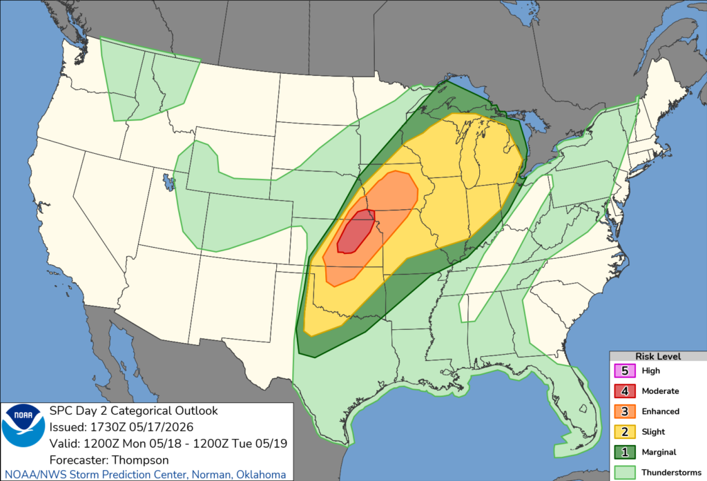
Forecasters said numerous severe thunderstorms are expected to develop Monday along a cold front stretching from the Great Lakes into the Plains. The strongest storms are expected from Kansas into Nebraska and Iowa, where atmospheric conditions are forecast to become highly unstable by Monday afternoon and evening.
Des Moines was specifically listed among the larger population centers in the enhanced risk area.
The Storm Prediction Center warned that storms could produce very large hail, destructive wind gusts and tornadoes. Heavy rainfall may also lead to localized flooding and hazardous travel conditions.
Those threats could impact schools across Iowa if storms cause widespread power outages, downed trees, road flooding or structural damage. District officials may decide to close schools, delay classes or dismiss students early depending on how conditions develop overnight and during the day Monday.
Forecasters also said morning storms moving through portions of Iowa could leave behind rain-cooled air and additional rounds of thunderstorms later in the day, increasing concerns for repeated impacts in some areas.


