


OKLAHOMA — A Flood Watch remains in effect across a large portion of Oklahoma on Sunday as forecasters warn that additional rounds of heavy rainfall could lead to flash flooding and rising waterways.
The National Weather Service has placed dozens of counties under Flood Watches, including parts of northeastern, eastern, central and southern Oklahoma.
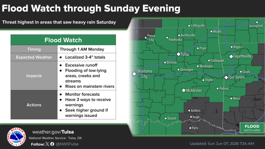
In northeastern Oklahoma, the Flood Watch remains in effect through late Sunday night. Counties included in the watch area include Tulsa, Rogers, Mayes, Delaware, Cherokee, Adair, Muskogee, Wagoner, Creek, Okmulgee, McIntosh, Pittsburg, Haskell, Latimer, Le Flore, Sequoyah, Ottawa, Craig, Nowata, Washington, Pawnee and Osage counties.
Forecasters said multiple rounds of showers and thunderstorms are expected throughout the day and into the evening, with localized rainfall totals of 3 to 4 inches possible. Excessive runoff could result in flooding of rivers, creeks, streams and other flood-prone locations.
Another Flood Watch remains in effect through Sunday afternoon for portions of central and southern Oklahoma, including Oklahoma, Cleveland, Canadian, Logan, Payne, Pottawatomie, Seminole, Garfield, Kingfisher, Grady, McClain, Garvin, Murray, Carter, Love, Marshall, Bryan, Johnston, Atoka, Comanche, Stephens and several surrounding counties.
The National Weather Service warned that additional rainfall could cause creeks and streams to rise out of their banks and lead to flooding in low-lying areas.
Residents in watch areas are encouraged to monitor weather conditions, stay alert for possible Flood Warnings and avoid driving through flooded roadways.
The Flood Watches remain in effect through Sunday afternoon or Sunday night depending on location.


