


MARYLAND — Maryland is included in a slight risk area for severe thunderstorms Thursday as a strong weather system moves across the Mid-Atlantic, according to the National Weather Service’s Storm Prediction Center.
Forecasters say isolated to scattered severe thunderstorms are possible across the state during the day and into the evening. Damaging wind gusts are expected to be the primary hazard, although a brief tornado cannot be ruled out in some areas.
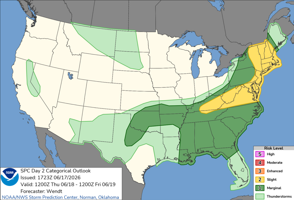
A powerful upper-level trough and an associated cold front are expected to sweep through the region Thursday. Thunderstorms may already be ongoing across parts of the Mid-Atlantic during the morning hours, but additional development is expected as the front moves eastward during the afternoon.
Meteorologists say strong wind fields in the atmosphere will support the potential for damaging winds with thunderstorms. Some storms may organize into bowing segments or isolated rotating cells capable of producing locally stronger wind damage.
The greatest threat is expected during the afternoon and early evening as storms move east across Maryland. Forecasters note that if enough sunshine develops ahead of the storms, atmospheric instability could increase and allow for a slightly greater risk of severe weather.
Residents are encouraged to monitor the latest forecasts and have multiple ways to receive weather warnings as thunderstorms approach.


