


NEW JERSEY — New Jersey is facing an increased risk of severe thunderstorms Saturday, with damaging wind gusts expected to be the primary hazard as storms move across the region.
According to the Storm Prediction Center, much of New Jersey is included in a slight risk area for severe weather. Forecasters warn that thunderstorms developing across the Ohio Valley and Northeast could organize into powerful clusters capable of producing widespread damaging winds during the afternoon and evening hours.
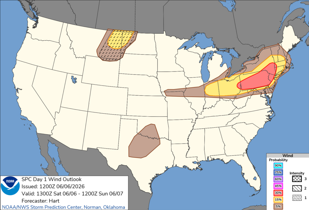
The SPC’s latest wind outlook places portions of New Jersey within a 30% risk area for severe wind reports, one of the highest wind threat levels highlighted in Saturday’s forecast. Major population centers including Newark and Jersey City are included in the area of greatest concern.
Forecasters say strengthening atmospheric winds associated with a deepening upper-level storm system moving through the Great Lakes will support the development of strong to severe thunderstorms. Wind gusts capable of downing trees, damaging power lines and causing scattered power outages are possible.
Isolated large hail may also accompany some of the stronger storms, although damaging winds are expected to be the primary threat.
The Storm Prediction Center noted that if thunderstorms become sufficiently organized and enough daytime heating develops, a widespread damaging wind event could unfold across parts of New Jersey, Pennsylvania and New York later Saturday.
Residents are encouraged to closely monitor forecasts and weather alerts throughout the day and have multiple ways to receive warnings as severe weather develops.
The greatest threat is expected from Saturday afternoon into Saturday evening before storms move offshore overnight.


