


ALABAMA — Parts of Alabama could see strong to locally severe thunderstorms Tuesday as hot, humid conditions combine with daytime heating, according to the National Weather Service’s Storm Prediction Center.
The Storm Prediction Center has placed portions of southern Alabama under a Marginal Risk (Level 1 of 5) for severe thunderstorms through early Wednesday morning.
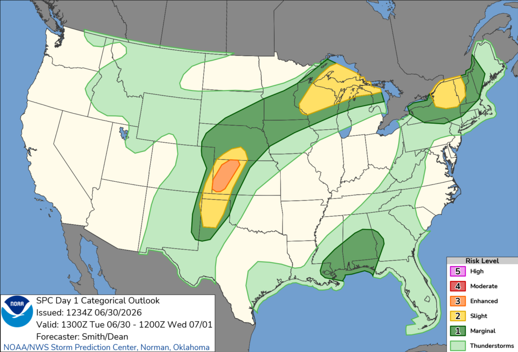
Forecasters say a very moist air mass remains in place across much of the Southeast beneath an upper-level high centered over the Ohio and Tennessee valleys. As temperatures climb Tuesday afternoon, moderate instability is expected to develop, fueling scattered thunderstorms.
The primary threat in Alabama will be isolated damaging wind gusts of 50 to 60 mph with the strongest storms. Forecast soundings indicate enough wind shear to support some organization of thunderstorms, although widespread severe weather is not expected.
While the risk is limited, a few storms could become strong enough to produce isolated wind damage before weakening later Tuesday evening.
Residents are encouraged to monitor the latest forecasts and be prepared to seek shelter if severe thunderstorm warnings are issued for their area.


