


MICHIGAN — Parts of Michigan are at risk for severe thunderstorms Tuesday as a weather system moves across the Upper Midwest, according to the National Weather Service’s Storm Prediction Center.
The Storm Prediction Center has placed portions of the Upper Peninsula and northern Lower Michigan under a Slight Risk (Level 2 of 5) for severe thunderstorms through early Wednesday morning. While the highest threat for widespread severe weather is expected across the central High Plains, forecasters say organized severe storms are also likely to develop across parts of the Upper Midwest, including Michigan.
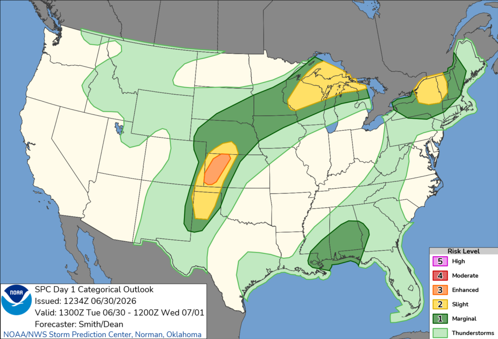
According to forecasters, showers and isolated thunderstorms already developing across the Upper Mississippi Valley Tuesday morning are expected to move east-northeast throughout the day. As temperatures rise and the atmosphere becomes increasingly unstable, additional thunderstorms are expected to develop across the region during the afternoon and evening.
The primary threats in Michigan include damaging wind gusts and large hail, although an isolated tornado cannot be ruled out with any storms that become supercells.
Meteorologists say abundant moisture, increasing instability and favorable wind shear will support organized thunderstorms capable of producing severe weather before activity gradually shifts northeast overnight.
Residents are encouraged to monitor the latest forecasts and be prepared to take shelter if severe thunderstorm or tornado warnings are issued for their area.


