


OHIO — Ohio is expected to face a heightened risk of severe weather on Wednesday as a powerful storm system moves across the Midwest, bringing the potential for tornadoes, damaging winds and large hail.
According to the National Weather Service Storm Prediction Center, much of Ohio is included in an area where significant severe weather is possible Wednesday into Wednesday night. While the highest risk is centered over parts of Illinois and Indiana, forecasters say conditions across Ohio will be favorable for severe thunderstorms capable of producing all hazards.
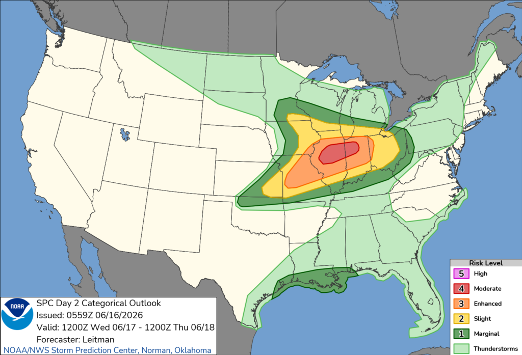
Meteorologists expect a strong upper-level disturbance and powerful jet stream winds to move into the region, combining with warm, humid air to create an increasingly unstable atmosphere. Forecasters say thunderstorms that develop across Illinois and Indiana during the afternoon may move into Ohio later in the day and overnight.
The Storm Prediction Center warns that severe storms could produce damaging wind gusts up to 80 mph, large hail up to 2.5 inches in diameter and tornadoes. Some tornadoes could become strong, particularly if storms remain isolated before forming into larger clusters or lines.
Forecasters say the exact placement of a warm front across the Midwest will play a major role in determining where the greatest tornado threat develops. However, strong wind fields and abundant instability are expected to support severe weather across portions of Ohio regardless of the precise location of the boundary.
In addition to tornadoes, widespread damaging winds may become the primary hazard if thunderstorms organize into a large line of storms Wednesday evening and overnight. Embedded tornadoes would remain possible even within a line of storms.
Ohio residents are encouraged to closely monitor forecasts and be prepared to receive weather warnings throughout Wednesday and Wednesday night as the severe weather threat unfolds.


