


PENNSYLVANIA — A late-season weather system could bring a chance of measurable snowfall to parts of Pennsylvania this weekend into early next week, according to the National Weather Service in Pittsburgh.
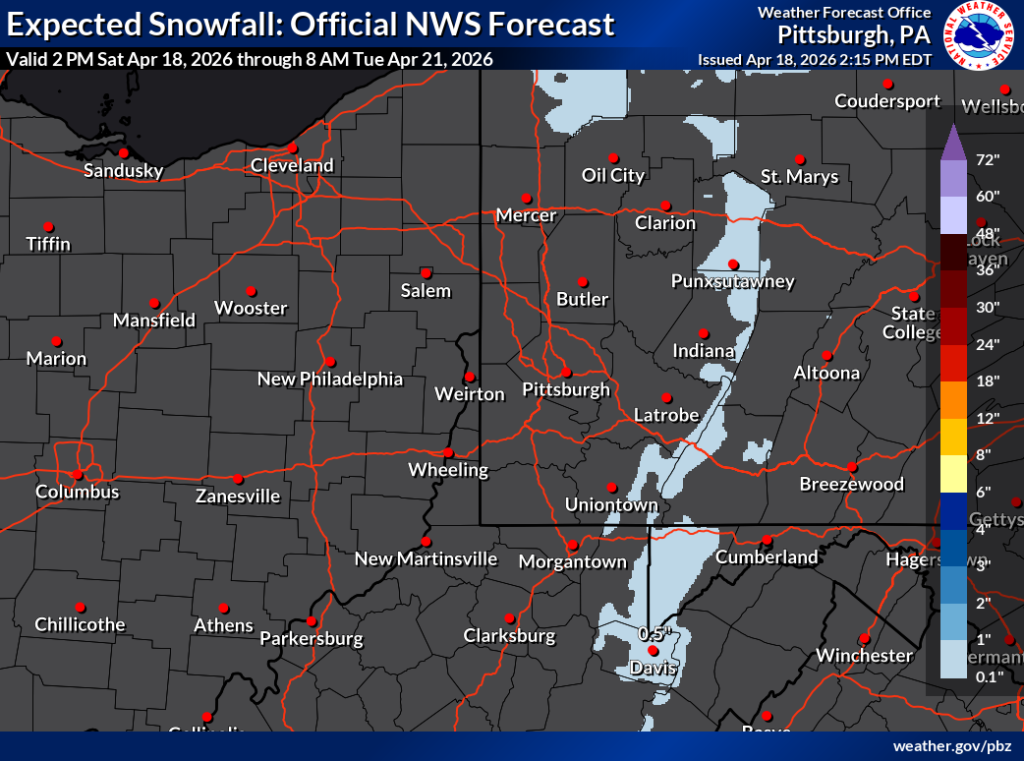
Forecast data shows the potential for light snow accumulations between Saturday afternoon and early Tuesday morning, particularly across western and central Pennsylvania. While most areas are expected to see little to no accumulation, forecasters say some locations could pick up minor totals, especially on grassy or elevated surfaces.
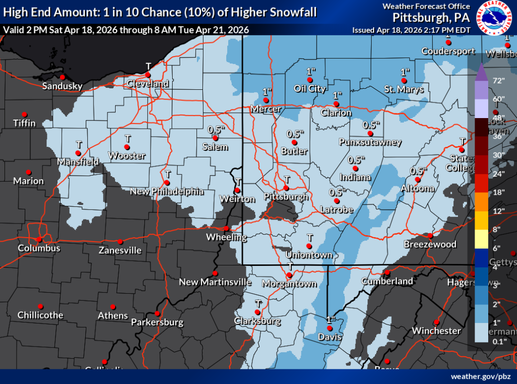
The official forecast indicates that much of western Pennsylvania, including the Pittsburgh area, is likely to see little accumulation, with totals generally remaining under a half-inch if snow occurs. However, parts of central and northern Pennsylvania — including areas near Clarion, DuBois, and St. Marys — could see around a half-inch to 1 inch of snow in isolated spots.
Higher elevations appear to have the best chance of measurable snowfall. The Laurel Highlands and areas stretching into the ridges of central Pennsylvania could see slightly higher totals, though still relatively minor for this time of year.
A secondary outlook from the National Weather Service, which represents a lower-probability but higher-impact scenario, suggests there is about a 10% chance that some areas could exceed those forecast totals. In that scenario, localized amounts could reach or slightly surpass 1 inch, mainly in northern and higher-elevation regions.
Despite the possibility of snow, temperatures and ground conditions typical of mid-April are expected to limit widespread accumulation. Any snow that does fall will likely melt quickly, especially on roadways.
Meteorologists emphasize that while measurable snowfall is possible, this system is not expected to produce significant impacts. Residents should be aware of changing conditions, particularly during overnight and early morning hours when temperatures are cooler.


