


TENNESSEE — Parts of Tennessee face a tornado threat Tuesday as multiple rounds of severe thunderstorms are expected to move across the state, according to the National Weather Service’s Storm Prediction Center.
Forecasters say Tennessee is included in a broad area of enhanced severe weather risk stretching from the southern Plains into the Lower Mississippi Valley and Mid-South.
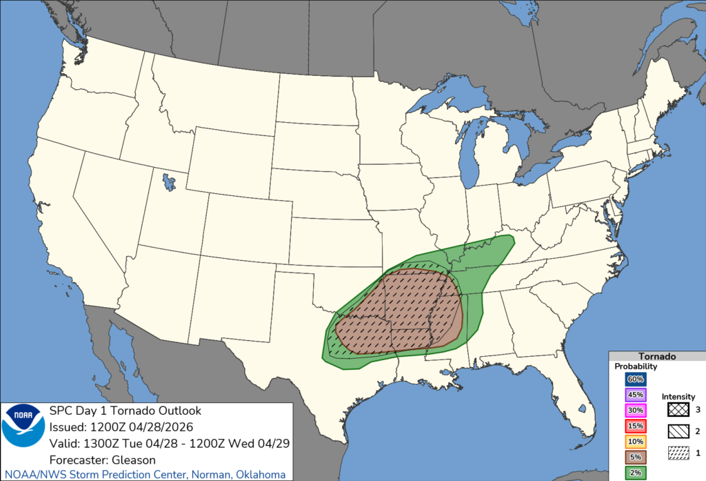
Meteorologists warn that strong to severe storms could produce tornadoes, along with very large hail and damaging winds.
The tornado threat is expected to increase during the afternoon and evening hours as storms track eastward into Tennessee from Arkansas and surrounding areas. Some storms may develop into supercells, which are capable of producing isolated tornadoes.
In addition to the tornado risk, storms could bring hail as large as 2 to 4 inches in diameter and wind gusts strong enough to cause widespread damage.
The Storm Prediction Center said multiple rounds of storms are possible, which could prolong the severe weather threat into the overnight hours.
Residents are urged to stay weather-aware, monitor forecasts and be prepared to take shelter quickly if warnings are issued.
The severe weather threat is expected to continue as storms move east across the region.


