


OHIO — Parts of Ohio are under an isolated tornado threat Saturday as the Storm Prediction Center includes portions of the state in its Day 1 Tornado Outlook.
The SPC’s latest outlook places a large area of Ohio, including Columbus, Akron and Canton, within a 2% tornado risk area through early Sunday morning. While the tornado threat is considered low, forecasters say conditions could support an isolated tornado as severe thunderstorms develop across the region.
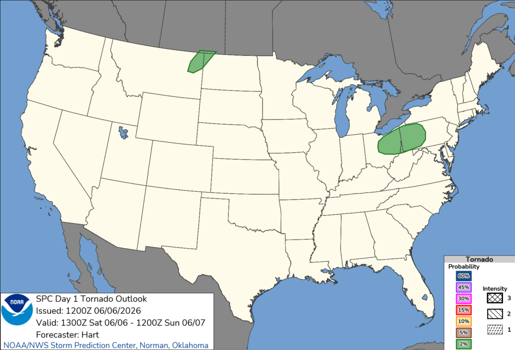
The tornado risk is part of a broader severe weather threat that stretches from Indiana into the Upper Ohio Valley and portions of the Northeast. Forecasters expect thunderstorms to intensify Saturday afternoon and evening as a strengthening storm system moves through the Great Lakes region.
According to the Storm Prediction Center, multiple clusters of thunderstorms are expected to develop and move across Ohio. Damaging wind gusts are the primary concern, but atmospheric conditions could also support isolated tornadoes and pockets of large hail.
Forecasters noted that ongoing thunderstorms from Illinois into Ohio and Pennsylvania may strengthen throughout the day. If sufficient daytime heating occurs and storms become more organized, the potential exists for a more widespread severe weather event across parts of the Ohio Valley and nearby states.
Residents are encouraged to monitor weather forecasts throughout the day, have multiple ways to receive warnings and be prepared to seek shelter if a tornado warning is issued.
The severe weather threat is expected to continue through Saturday evening before gradually shifting east overnight.


