


MISSOURI — Parts of Missouri are included in a severe weather outlook for Sunday that includes the potential for isolated tornadoes, according to the National Weather Service‘s Storm Prediction Center.
The Storm Prediction Center has placed portions of Missouri under a Marginal Risk, or Level 1 of 5, for severe thunderstorms from Sunday morning through early Monday morning.
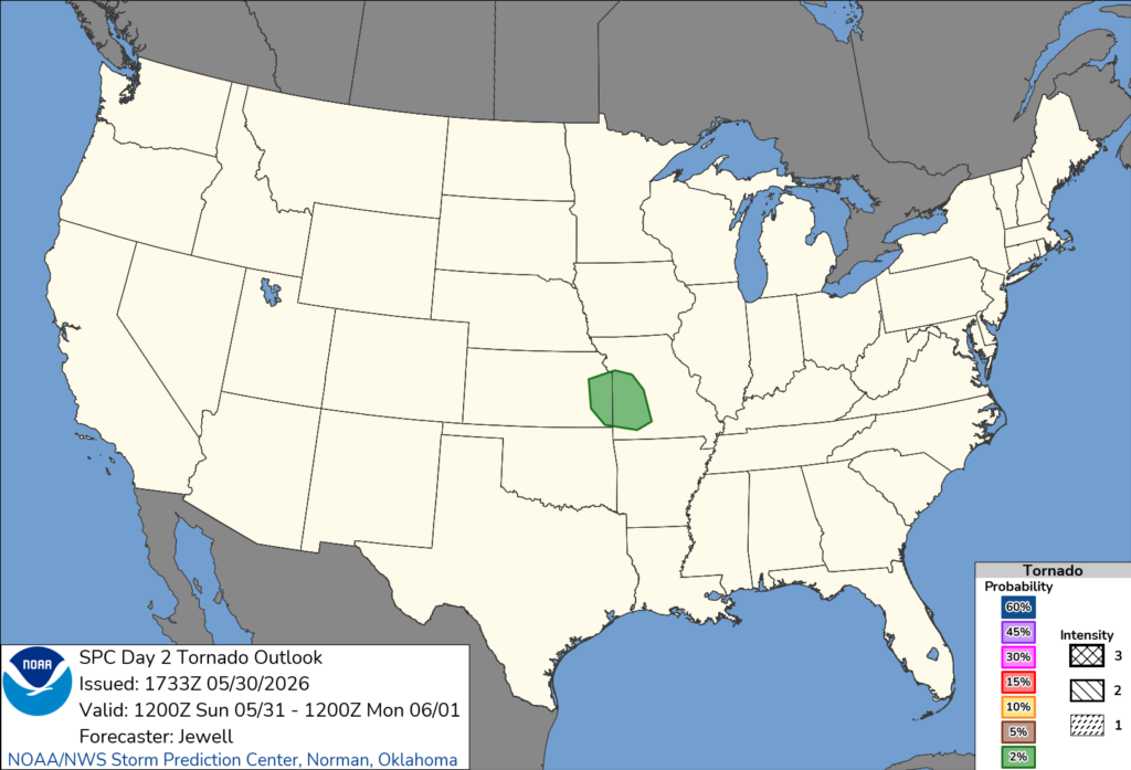
Forecasters say thunderstorms may develop Sunday afternoon and evening across eastern Kansas and western Missouri as instability increases across the region. While widespread severe weather is not expected, conditions could support a few stronger storms.
The Storm Prediction Center noted that a couple of supercell thunderstorms cannot be ruled out. Any storms that become supercells could produce large hail and a brief tornado.
The outlook also highlights the possibility that thunderstorms developing earlier in the day across southern Missouri could organize and move southeast, bringing locally damaging wind gusts to parts of the state.
Kansas City is among the larger population centers included within the tornado risk area outlined by forecasters. Other communities in western Missouri may also experience strong thunderstorms Sunday afternoon and evening.
Meteorologists emphasize that the tornado threat remains isolated, but residents are encouraged to monitor forecasts and have multiple ways to receive weather warnings should severe storms develop.
Additional updates are expected as forecasters refine the timing and location of Sunday’s strongest storms.