


KENTUCKY — Strong to severe storms are expected to move into Kentucky on Monday, bringing the potential for tornadoes as part of a widespread severe weather outbreak, according to the National Weather Service Storm Prediction Center.
Forecasters say Kentucky is included in a broad area of severe weather stretching from the mid-Mississippi Valley into the lower Ohio Valley, with conditions favorable for tornadoes, damaging winds and large hail.
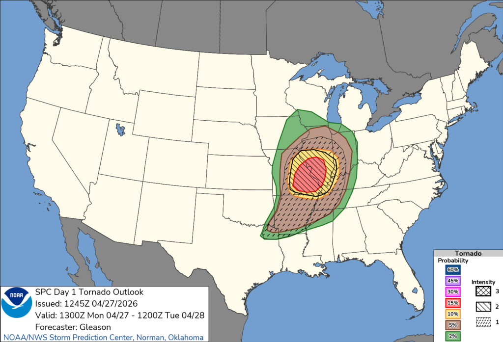
While the greatest risk for strong, long-track tornadoes is expected farther west into Missouri and Illinois, parts of Kentucky remain in an area where tornadoes are possible, especially during the afternoon and evening hours.
The Storm Prediction Center indicates portions of western Kentucky could see a higher tornado risk compared to areas farther east, as storms move in from Missouri and Arkansas.
Storms are expected to develop and intensify in an environment with warm, moist air and strong wind shear — conditions that can support rotating thunderstorms capable of producing tornadoes.
In addition to the tornado threat, large hail and damaging wind gusts are also possible.
Forecasters say storms may organize into clusters during the evening, with the potential for embedded tornadoes continuing into the overnight hours.
Residents are urged to stay weather-aware and have multiple ways to receive warnings as conditions evolve.


