


ILLINOIS — Parts of northern Illinois could see isolated tornadoes Friday afternoon and evening as severe thunderstorms develop across portions of the Midwest, according to the National Weather Service‘s Storm Prediction Center.
Forecasters have placed portions of northern Illinois within a slight risk area for severe thunderstorms, with the greatest threats expected to be large hail and damaging wind gusts. However, the Storm Prediction Center is also highlighting a low-end tornado risk across parts of the region.
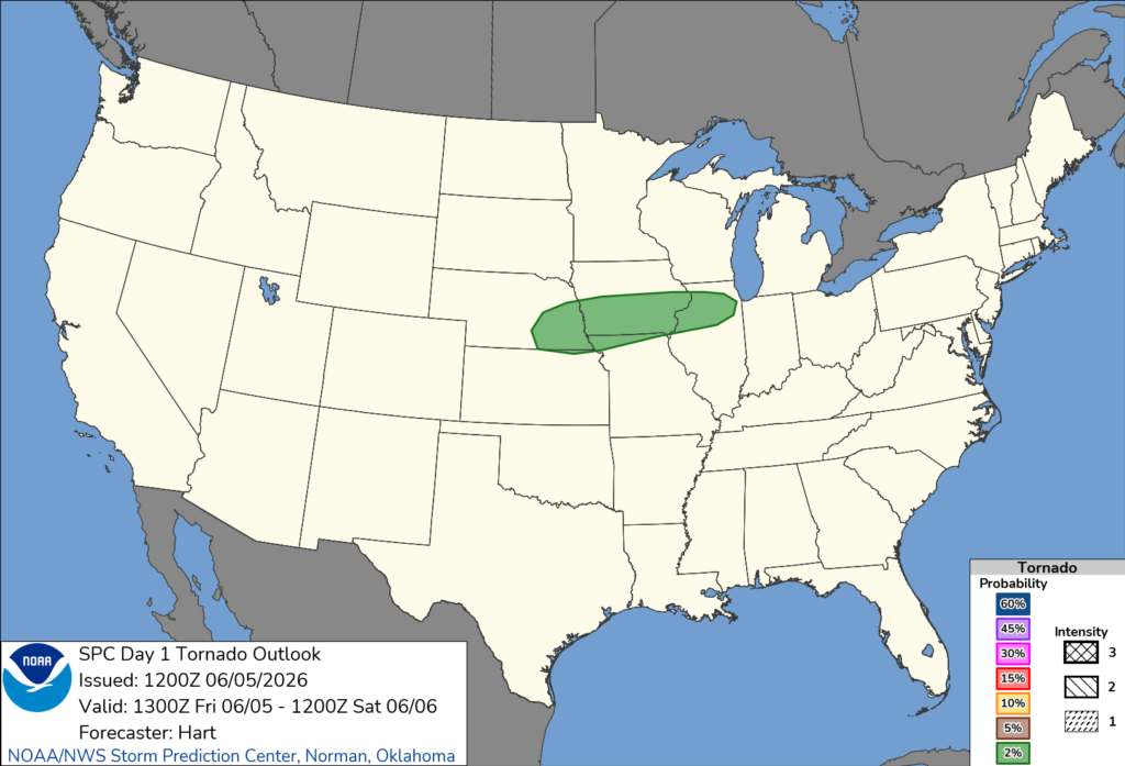
The agency’s latest outlook indicates thunderstorms are expected to develop late Friday along a frontal boundary stretching from Nebraska into Iowa before tracking eastward. Atmospheric conditions are expected to support supercell thunderstorms capable of producing large hail, while an isolated tornado cannot be ruled out.
The Storm Prediction Center has outlined a 2% tornado probability area that includes portions of northern Illinois. Communities within the risk area include Aurora and Naperville, along with parts of the greater Chicago metropolitan region.
Forecasters said low-level winds are not expected to be particularly strong, which should limit the overall tornado threat. As a result, widespread tornado activity is not anticipated. Still, officials caution that any tornado that develops could pose a danger to people and property.
In addition to the tornado threat, severe thunderstorms may produce damaging wind gusts and large hail as storms move eastward through the evening hours.
Residents across northern Illinois are encouraged to monitor forecasts throughout the day and have multiple ways to receive weather warnings should severe weather develop.


