


KENTUCKY — Parts of western Kentucky are under a risk for severe thunderstorms Monday, with forecasters warning that an isolated tornado cannot be ruled out.
According to the National Weather Service Storm Prediction Center’s Day 1 Convective Outlook, western Kentucky is included in an area where a few strong to severe storms may develop through Monday and into the evening hours.
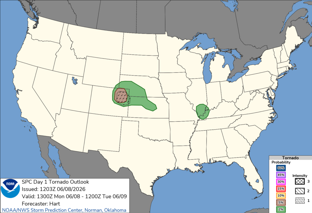
Forecasters said a moist and moderately unstable air mass is in place across southern Illinois and western Kentucky as an upper-level disturbance moves through the mid-Mississippi Valley. While widespread severe weather is not expected, atmospheric conditions could support a few stronger storms capable of producing damaging wind gusts and an isolated tornado.
The Storm Prediction Center noted that winds changing direction with height, combined with sufficient instability, create an environment favorable for occasional severe thunderstorms. In addition to the tornado threat, some storms could produce strong wind gusts.
The tornado risk for Kentucky remains relatively low and isolated, but forecasters encourage residents to remain weather aware and have multiple ways to receive warnings should storms develop.
The greatest severe weather threat nationally Monday is expected farther west across parts of eastern Colorado, southeast Wyoming, Nebraska and Kansas, where large hail, damaging winds and a few tornadoes are possible.
Kentucky residents are encouraged to monitor the latest forecasts and be prepared for rapidly changing weather conditions throughout the day.


