


TENNESSEE — Parts of western Tennessee could see severe thunderstorms on Sunday as a storm system moves across the central United States, according to the National Weather Service’s Storm Prediction Center.
The SPC’s Day 3 Convective Outlook places portions of western Tennessee under a Marginal Risk (Level 1 of 5) for severe weather on Sunday, June 21. While the state is not included in the higher-risk areas farther west, forecasters say isolated severe thunderstorms remain possible.
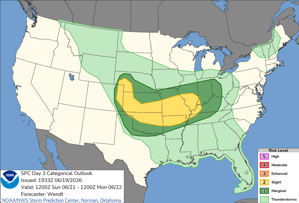
The primary threats in western Tennessee are expected to be damaging wind gusts and large hail, though a brief tornado cannot be ruled out if storms become stronger.
The severe weather threat is expected to develop during the afternoon and evening as warm, humid air combines with an approaching weather system. Thunderstorms may become strong enough to produce isolated severe weather before weakening later Sunday night.
The Storm Prediction Center advises Tennessee residents, especially those in the western part of the state, to monitor updated forecasts through the weekend and have multiple ways to receive weather warnings should conditions worsen. Forecast details may change as confidence increases closer to Sunday’s event.


