


INDIANA — Indiana residents should prepare for the potential of significant severe weather on Wednesday as forecasters warn of a heightened risk for severe thunderstorms capable of producing tornadoes, destructive winds and large hail.
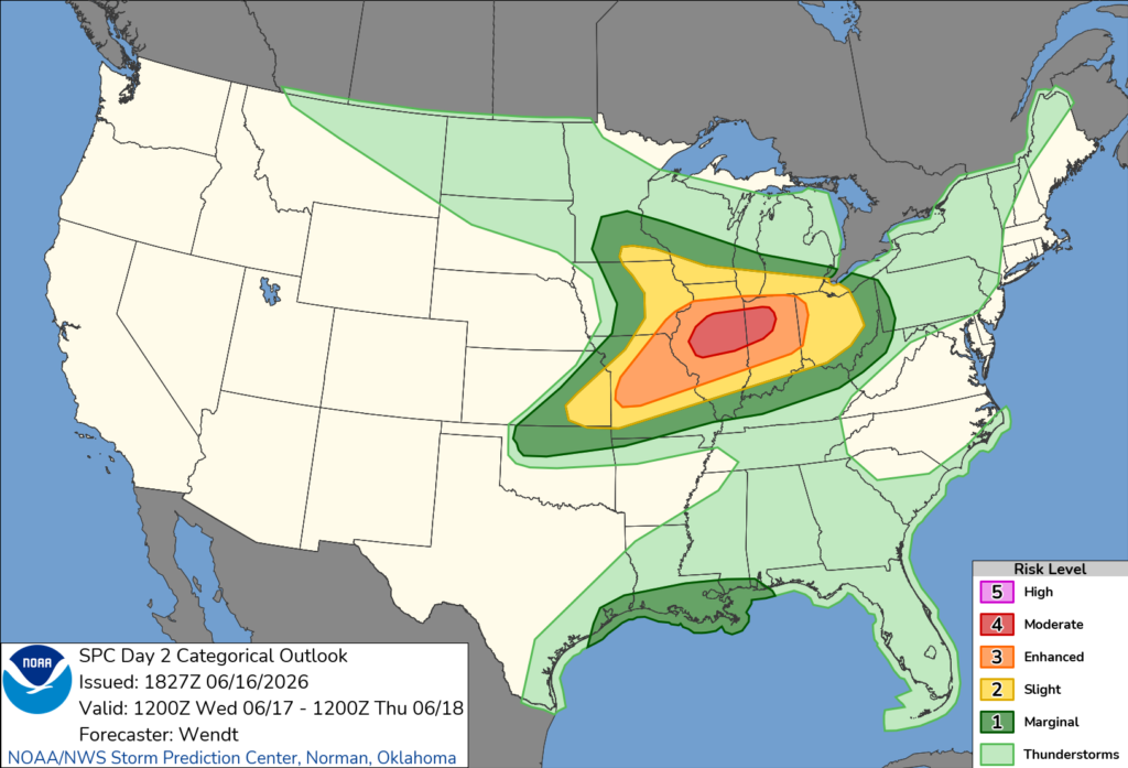
The Storm Prediction Center has placed parts of northwest Indiana under a Moderate Risk (Level 4 of 5) for severe weather, with a broader area of the state included in lower severe weather risk categories.
According to forecasters, a powerful storm system moving across the Midwest and Great Lakes will create favorable conditions for severe thunderstorms throughout the day. Meteorologists say the setup could support all forms of severe weather, including strong to intense tornadoes, wind gusts reaching 80 mph, and hail up to 2.5 inches in diameter.
Thunderstorms may begin affecting Indiana during the morning as a cluster of storms moves east from Illinois. Some of these storms could produce damaging winds, though forecasters say the severity and longevity of the morning activity remain uncertain.
The more significant threat is expected to develop during the afternoon and evening hours. As atmospheric moisture increases across Indiana, storms are expected to strengthen and become more organized. Weather experts say conditions will be favorable for rotating supercell thunderstorms capable of producing large hail, destructive straight-line winds and tornadoes.
Northern and northwestern Indiana appear to face the greatest threat, particularly as storms move eastward from Illinois and encounter increasingly favorable conditions.
Officials encourage residents to closely monitor weather forecasts, review severe weather safety plans and ensure they have multiple ways to receive warnings, especially during the afternoon and evening when the most dangerous storms are expected.
The severe weather threat is expected to diminish overnight as the storm system moves east of the region.


