


NORTH CAROLINA — Strong to severe thunderstorms capable of producing damaging wind gusts are possible across North Carolina Friday afternoon and evening as a hot, humid air mass combines with daytime heating, according to the Storm Prediction Center.
Forecasters have placed much of North Carolina within a Slight Risk (Level 2 of 5) for severe weather as storm activity develops across the southern Mid-Atlantic and Carolinas. The primary threat is expected to be damaging straight-line winds, although isolated hail cannot be ruled out in the strongest storms.
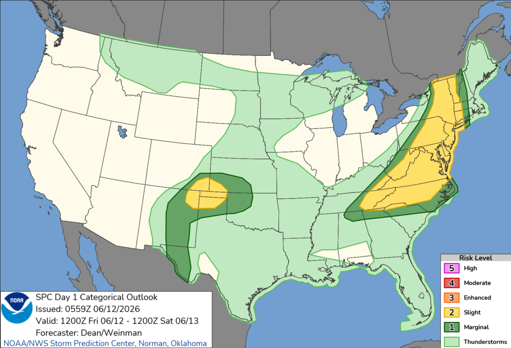
Meteorologists say very strong heating of the moist air mass across the region will help fuel scattered thunderstorms during the afternoon. Some of these storms could produce powerful downburst winds before organizing into clusters capable of generating widespread strong wind gusts.
The threat is expected to continue through the afternoon and into the early evening hours before storms gradually weaken later tonight.
Cities across central and western North Carolina, including the Charlotte area, are included within the broader severe weather risk area outlined by the Storm Prediction Center.
Residents are encouraged to stay weather-aware throughout the day, monitor forecasts for updates and be prepared to move indoors quickly if severe thunderstorm warnings are issued.


