


MINNESOTA — Minnesota could see severe thunderstorms Monday as a weather system moves across the northern Plains into the Upper Midwest, bringing the potential for large hail, damaging winds, and a few tornadoes.
According to the National Weather Service’s Storm Prediction Center, portions of Minnesota are included in a Slight Risk for severe thunderstorms through early Tuesday morning.
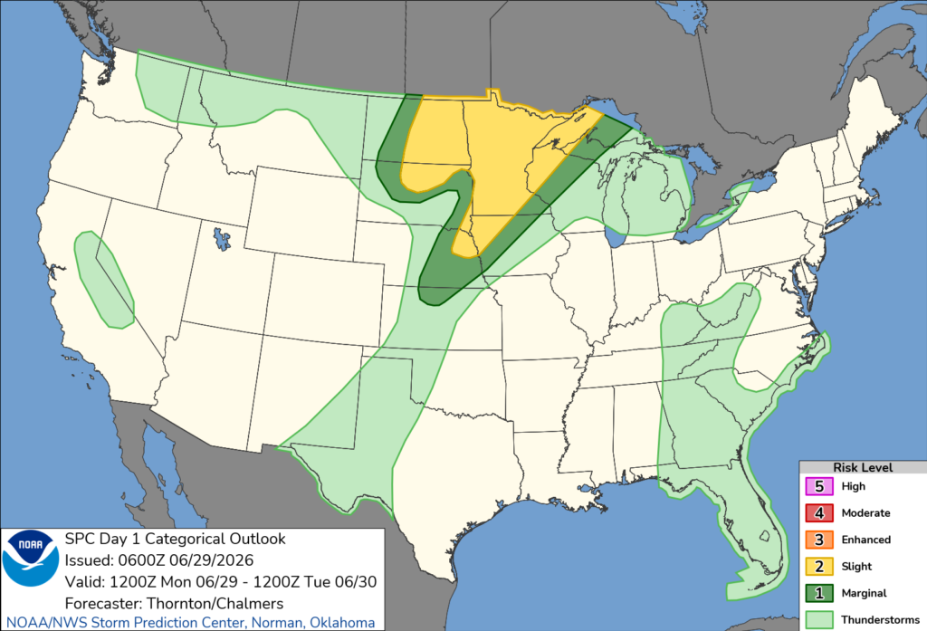
Forecasters say thunderstorms are expected to develop as a warm front lifts into Minnesota during the afternoon. While the exact evolution of morning storms remains uncertain, additional thunderstorms are expected to form later in the day near the warm front.
Meteorologists say filtered sunshine and increasing instability during the afternoon, combined with strong winds higher in the atmosphere, will create an environment capable of supporting supercell thunderstorms. If storms become rooted at the surface, they could produce all types of severe weather, including large hail, damaging wind gusts, and a couple of tornadoes.
Large hail and damaging straight-line winds are expected to be the primary threats across the state, although the tornado risk is considered more isolated.
The storm system is associated with a low-pressure area moving from Nebraska into the Dakotas, with a warm front extending into Minnesota as the day progresses. Strong wind shear and favorable atmospheric conditions are expected to support organized severe thunderstorms where they develop.
Forecasters note there is still some uncertainty regarding how storms will evolve throughout the day, but residents are encouraged to monitor the latest forecasts and have multiple ways to receive weather warnings if severe weather develops.


