


ALABAMA — UPDATE: The watches have expired.
—
A Severe Thunderstorm Watch has been issued for portions of Alabama until 7 p.m. CDT Monday as forecasters warn that strong to severe thunderstorms are expected to develop during the afternoon and continue into the evening.
According to forecasters, storms are expected to develop during the early afternoon and move east across the state between 1 p.m. and 9 p.m. The strongest storms could produce damaging wind gusts, flash flooding, and an isolated tornado or two.
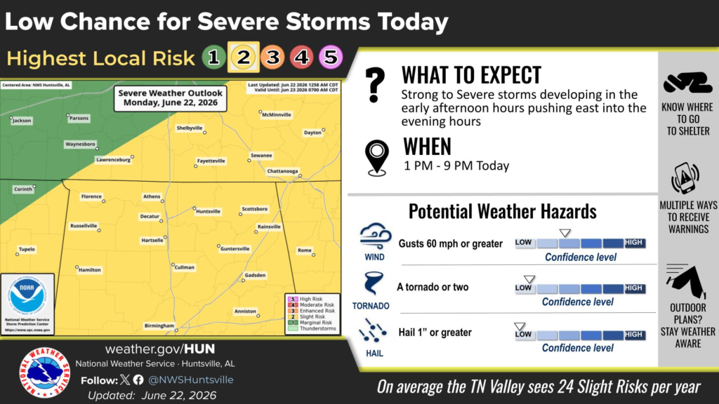
The Severe Thunderstorm Watch includes the Alabama counties of Bibb, Blount, Calhoun, Cherokee, Colbert, Cullman, DeKalb, Etowah, Fayette, Franklin, Greene, Hale, Jackson, Jefferson, Lamar, Lauderdale, Lawrence, Limestone, Madison, Marion, Marshall, Morgan, Pickens, Shelby, St. Clair, Sumter, Talladega, Tuscaloosa, Walker, and Winston.
Residents in the watch area are encouraged to closely monitor changing weather conditions throughout the day and be prepared to take shelter if severe thunderstorm or tornado warnings are issued. Repeated heavy rainfall may also result in localized flash flooding, particularly in low-lying and poor drainage areas.
Forecasters urge Alabamians to have multiple ways to receive weather alerts as storms move across the state Monday afternoon and evening.


