


MISSOURI — Forecasters with the National Weather Service Storm Prediction Center have issued a moderate risk for severe weather across parts of Missouri on Monday, with the potential for multiple strong tornadoes.
The outlook highlights the mid-Mississippi Valley, including much of Missouri, as a primary area of concern for dangerous storms expected to develop through the afternoon and evening.
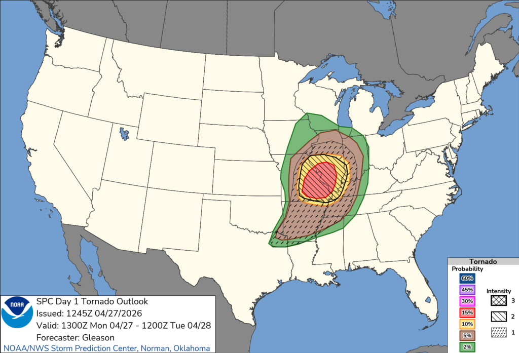
According to forecasters, numerous severe thunderstorms are expected, with the potential for “multiple strong to intense tornadoes,” some of which could reach EF-2 or EF-3 strength or higher.
Storms are expected to develop during the afternoon as discrete supercells ahead of an approaching cold front. These storms could rapidly intensify in an environment with strong wind shear and increasing instability — conditions favorable for tornado development.
The greatest tornado threat is expected across central and eastern Missouri, particularly near a frontal boundary where rotating storms are most likely to form.
In addition to tornadoes, very large hail up to 2 to 3 inches in diameter and widespread damaging winds are also possible.
Forecasters say the threat will continue into the evening hours as storms begin to organize into clusters, with the potential for additional tornadoes embedded within the system.
Residents are urged to stay weather-aware, have multiple ways to receive warnings, and be prepared to take shelter quickly if warnings are issued.


