


OHIO — Residents in several southeast Ohio counties are under a Flood Watch from 8 a.m. Monday through Monday evening as forecasters warn that repeated rounds of showers and thunderstorms could bring heavy rainfall and the potential for flash flooding.
The National Weather Service has issued the watch for Athens, Gallia, Jackson, Lawrence, Meigs, Vinton and Washington counties.
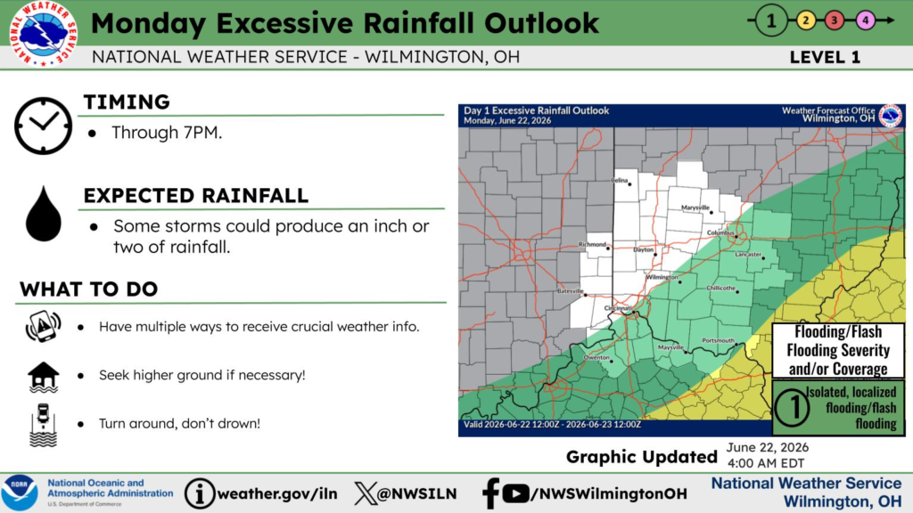
According to the National Weather Service, scattered showers and thunderstorms are expected to develop throughout the day ahead of and along an approaching cold front. Rainfall totals of 1 to 2 inches are expected across portions of the region, with some locations potentially receiving even higher amounts.
Forecasters say the heaviest rainfall could lead to excessive runoff, causing rivers, creeks, streams and other low-lying and flood-prone areas to flood. Areas that received significant rainfall last week are considered especially vulnerable to flash flooding.
Residents are encouraged to closely monitor the latest weather forecasts throughout the day and be prepared to take action if Flash Flood Warnings are issued for their area. Drivers should never attempt to travel through flooded roadways, as water depths and road conditions can be difficult to determine.
The Flood Watch remains in effect from 8 a.m. Monday through Monday evening.


