


WISCONSIN — Wisconsin is facing the threat of severe thunderstorms Wednesday as forecasters warn that multiple rounds of storms could bring destructive winds, large hail and a few tornadoes across much of the state.
The National Weather Service’s Storm Prediction Center has placed much of Wisconsin under an Enhanced Risk for severe weather, indicating an increased likelihood of widespread severe thunderstorms.
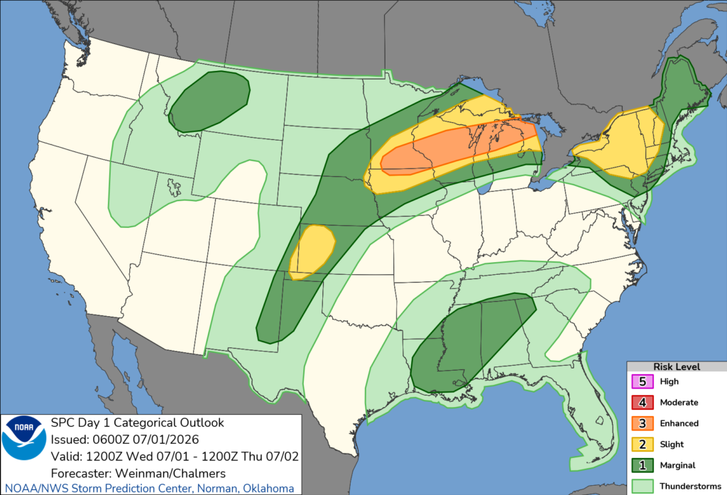
Forecasters say storms developing across southern Minnesota are expected to spread east-northeast into Wisconsin during the day. The initial round of storms could produce damaging wind gusts and large hail.
As the atmosphere becomes increasingly unstable through the afternoon and evening, a second round of thunderstorms is expected to develop and move into Wisconsin. These storms could organize into supercells and larger storm clusters capable of producing widespread severe weather.
The greatest threats include damaging wind gusts that could reach 80 mph, large to very large hail and a few tornadoes. Forecasters say the strongest storms are expected during the afternoon and evening hours as they track east-northeast across the state.
The Storm Prediction Center said scattered severe thunderstorms are expected across the Upper Midwest and Great Lakes through Wednesday and Wednesday night, with damaging winds posing the primary hazard.
Wisconsin residents are encouraged to closely monitor weather forecasts throughout the day and ensure they have multiple ways to receive weather warnings should severe storms develop.


