


ALABAMA — Parts of Alabama are under a Slight Risk (Level 2 of 5) for severe thunderstorms Monday, with the potential for damaging wind gusts and a brief tornado or two as storms move across the Southeast this afternoon and evening, according to the National Weather Service’s Storm Prediction Center.
Forecasters say multiple rounds of thunderstorms are expected to develop and spread eastward across much of the Southeast through at least the early evening. The strongest storms could organize into clusters capable of producing scattered damaging winds, while an isolated tornado cannot be ruled out.
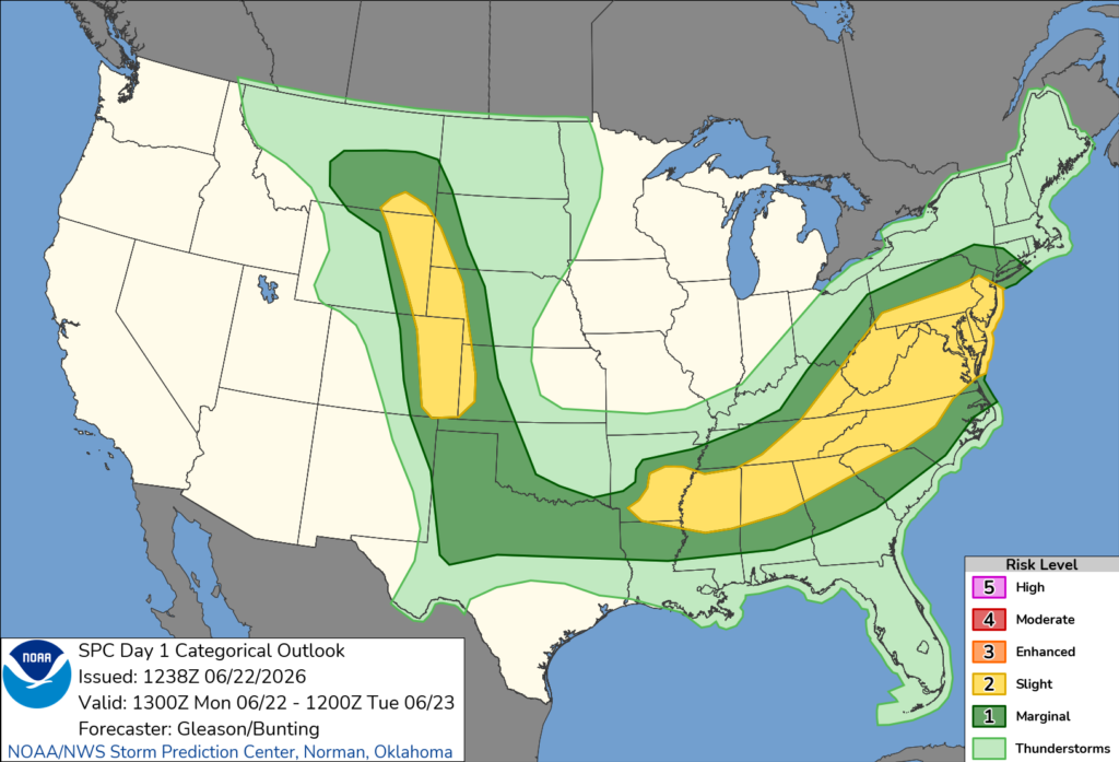
The severe weather threat follows a weakening complex of thunderstorms that moved across Arkansas and northeast Texas Monday morning. Although that system is expected to weaken, weather experts say it will help create favorable conditions for new storm development across Alabama later in the day.
A warm, humid air mass remains in place across the region, with dew points generally in the lower to middle 70s. While widespread cloud cover may limit daytime heating somewhat, enough atmospheric instability is expected to develop to support strong to severe thunderstorms.
The Storm Prediction Center said enhanced winds higher in the atmosphere will allow some storms to become organized, increasing the risk for damaging straight-line winds. A couple of tornadoes are also possible, although forecasters indicate the tornado threat is expected to remain relatively limited.
Residents across Alabama are encouraged to monitor the latest forecasts throughout the day and be prepared to seek shelter if severe thunderstorm or tornado warnings are issued for their area.


