


NEW JERSEY — Strong to severe thunderstorms are possible across New Jersey on Friday as a weather disturbance moves through the Northeast, bringing the potential for damaging wind gusts during the afternoon and evening hours.
The National Weather Service‘s Storm Prediction Center has placed much of New Jersey within a Slight Risk (Level 2 of 5) for severe weather. Forecasters say conditions will be favorable for scattered thunderstorms to develop as daytime heating combines with modest atmospheric instability across the region.
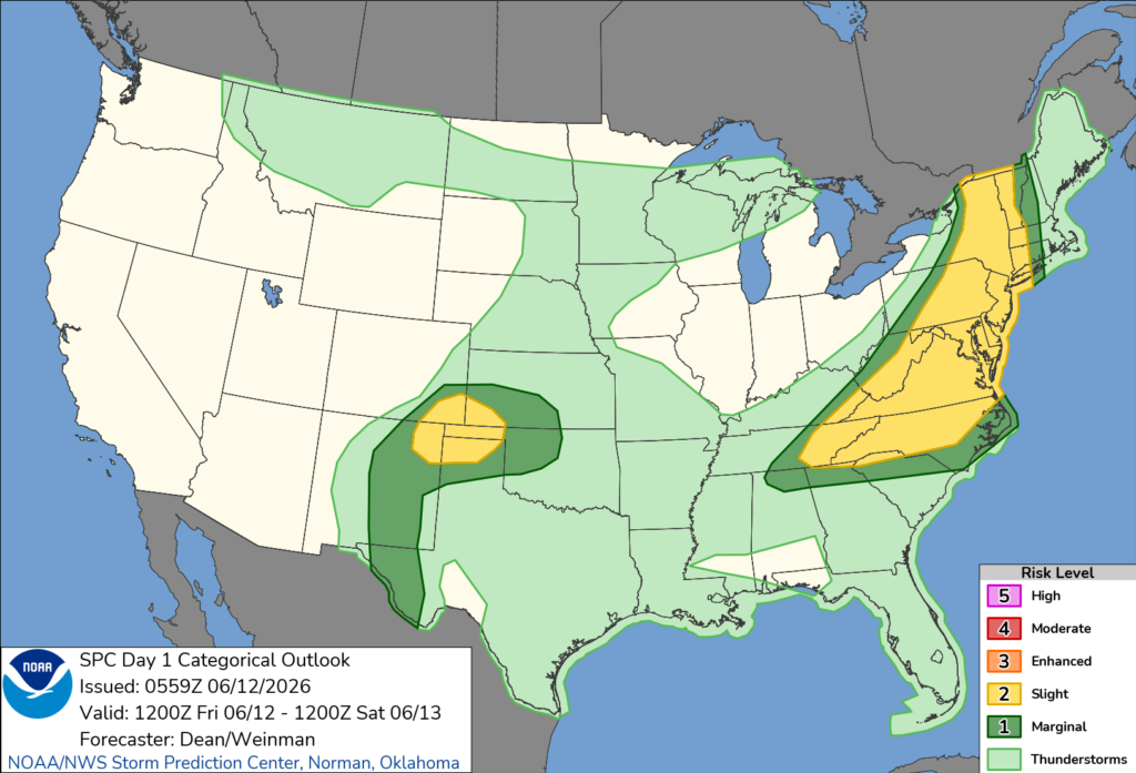
According to the Storm Prediction Center, the primary threat will be damaging straight-line winds. Storms may organize into clusters and move eastward through the state, producing wind gusts capable of downing trees, damaging power lines and causing scattered power outages.
Forecasters also say isolated hail is possible in the strongest thunderstorms, although damaging winds remain the main concern.
The severe weather threat is expected to increase during the afternoon and continue into the evening before storms gradually weaken overnight. Areas across northern, central and southern New Jersey could experience strong storms as the system moves through the region.
Residents are encouraged to stay weather-aware throughout the day, monitor the latest forecasts and have multiple ways to receive weather warnings. Any severe thunderstorms that develop could also produce frequent lightning and heavy downpours in addition to strong winds.


