


INDIANA — Parts of northern Indiana are under an elevated risk for tornadoes Thursday as a significant severe weather outbreak develops across the Midwest, according to the National Weather Service‘s Storm Prediction Center.
The Storm Prediction Center’s latest Day 1 Convective Outlook places northern Indiana within a 10% tornado probability area, with communities near Gary and areas bordering Illinois facing some of the highest tornado risks in the state.
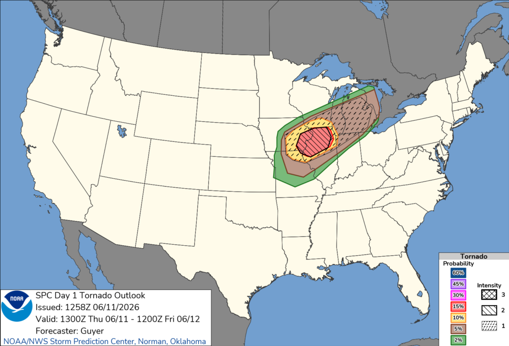
Forecasters warned that widespread severe thunderstorms are expected across portions of the Midwest and Great Lakes region, including northern Illinois, southern Wisconsin, Lower Michigan and northern Indiana. The storms will be capable of producing damaging winds, large hail and tornadoes, some of which could be strong.
Meteorologists said a well-organized line of severe storms moving east from Iowa and Illinois is expected to continue strengthening as it advances across the region. Atmospheric conditions are becoming increasingly favorable for tornado development, particularly near storm boundaries and along an approaching cold front.
In addition to the tornado threat, forecasters are warning of potentially widespread damaging wind gusts capable of causing power outages, downed trees and structural damage.
The Storm Prediction Center noted that storm development later Thursday afternoon and evening could lead to another round of severe weather across Indiana as storms move eastward from Illinois and continue organizing.
Residents across northern Indiana are encouraged to closely monitor weather forecasts throughout the day, ensure they have multiple ways to receive warnings and be prepared to seek shelter immediately if tornado warnings are issued.


