


FLORIDA — Forecasters with the National Weather Service’s Storm Prediction Center are warning of a potential severe weather outbreak across parts of Florida this weekend, with damaging winds as the primary concern and a limited but notable tornado threat.
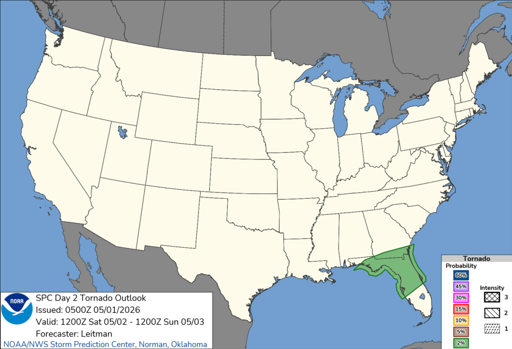
According to the latest Day 2 Convective Outlook issued early Friday, a slight risk of severe thunderstorms has been outlined from southern Georgia into north-central Florida, including major population centers such as Jacksonville, Orlando, Tampa, and St. Petersburg.
Storms are expected to develop and move through the region Saturday morning into the early evening hours as a strong upper-level system pushes east across the Southeast. A cold front draped near the Florida-Georgia line will serve as the focus for thunderstorm development.
Forecasters say conditions will support organized storms, including the potential for clusters or a line of thunderstorms capable of producing damaging wind gusts. While instability is expected to increase during the day, especially where sunshine breaks through, the overall setup introduces some uncertainty regarding storm structure.
The tornado risk, while present, is considered less certain. Meteorologists cite a weakening low-level jet and questions about how storms will evolve as limiting factors. However, they caution that isolated tornadoes cannot be ruled out, particularly if storms become more discrete rather than forming a solid line.
In addition to the tornado potential, isolated hail may also occur with stronger storms.
Residents across northern and central Florida are encouraged to monitor weather updates closely and have multiple ways to receive warnings, especially as storms may begin early in the day.


