


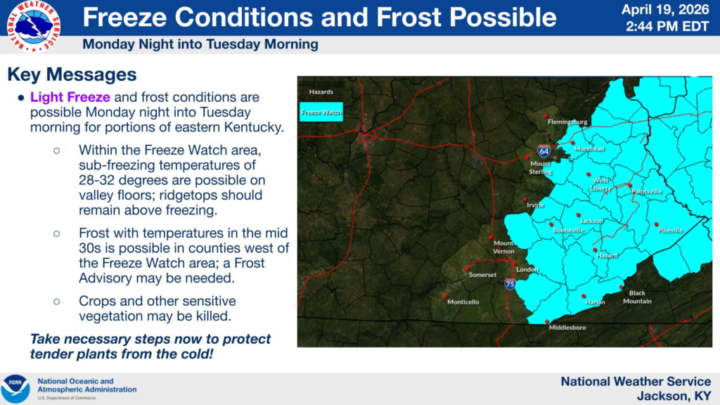
KENTUCKY — A freeze watch has been issued for much of eastern Kentucky late Monday night into Tuesday morning, with forecasters warning of sub-freezing temperatures that could impact travel and potentially lead to school delays or closures early April 21.
According to the National Weather Service in Jackson, temperatures are expected to fall between 28 and 32 degrees in valley locations across a large portion of the region. Counties included in the watch span northeast, east-central and southeast Kentucky, including Rowan, Menifee, Morgan, Johnson, Floyd, Pike, Knott, Perry, Letcher, Harlan, Bell and Knox counties.
Forecasters say while the primary concern is the freeze itself, any residual moisture on roadways could freeze overnight, especially on bridges, overpasses and untreated secondary roads.
Though widespread precipitation is not expected, isolated light snow showers or flurries cannot be ruled out in some higher elevation areas, which could briefly reduce visibility and contribute to slick spots.
The potential for icy patches during the early morning commute Tuesday may prompt some school districts, particularly in rural and mountainous areas, to consider delays or closures.
In addition to travel concerns, the freeze could kill crops and other sensitive vegetation, as well as damage unprotected outdoor plumbing.
Residents are urged to take precautions ahead of the cold snap, including protecting plants, covering exposed pipes and allowing extra travel time during the morning commute.


