


OHIO — A widespread freeze warning is in effect across much of Ohio late Sunday night into Monday morning, bringing the potential for hazardous travel and possible school disruptions on April 20.
The National Weather Service said sub-freezing temperatures, dropping into the mid-20s to lower 30s, are expected across a large portion of the state. Areas under the warning include northwest Ohio counties such as Lucas, Wood, Ottawa, Sandusky and Hancock, as well as northeast and north-central Ohio counties including Cuyahoga, Summit, Medina, Lorain, Lake, Geauga, Portage and Trumbull.
Additional central and southern counties — including Delaware, Licking, Fairfield and Hocking — are also under freeze warnings early Monday.
Forecasters warn that any standing water left on roadways from recent rain could freeze overnight, creating slick spots for the Monday morning commute. Bridges, overpasses and untreated roads will be especially susceptible to icy conditions.
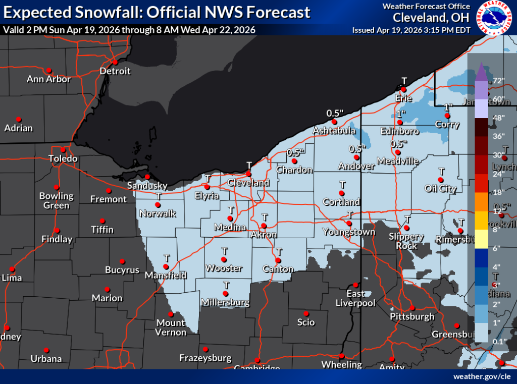
While the primary concern is freezing temperatures, some areas of northern and northeastern Ohio could also see isolated light snow showers overnight into early Monday. Any accumulation is expected to be minimal, but even brief snow could further reduce visibility and contribute to hazardous road conditions.
The combination of freezing temperatures and potential icy roads may lead some school districts to consider delays or closures Monday morning, particularly in areas where untreated roads or rural routes are more common.
In addition to travel concerns, officials say the cold could damage crops, vegetation and exposed outdoor plumbing.
A second round of cold air is also expected, with a freeze watch in place for Monday night into Tuesday morning across much of Ohio.
Residents are urged to take precautions, including protecting plants, covering outdoor pipes and allowing extra time for the morning commute.


