OHIO — Could it be so? Weather models are showing snow showers across Ohio beginning on Thursday.
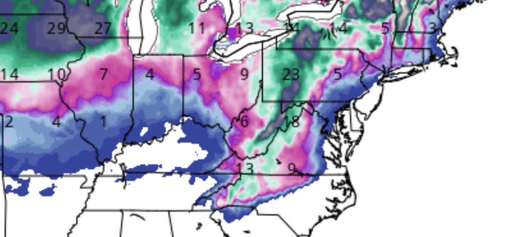
Shown above is the GFS model showing the total predicted snow accumulation from this Thursday to Tuesday, December 3.
It’s important to note that this is only a model and not a forecast. Models change daily and even by the hour sometimes.

The current run of the GFS model as of Sunday afternoon shows northern Ohio getting the bulk of the potential snow accumulation from a few inches to 9 inches near Cleveland.
According to AccuWeather, in Columbus, their forecast shows a mix of rain and snow beginning on Thursday with the high only being 37 degrees.
Their forecast is currently showing little snow accumulation to end the week across Ohio, but readers are encouraged to stay up to date on the latest forecasts.
The latest National Weather Service forecasts may be viewed here.


